
Image: 1927 map of Southwest Los Angeles, California
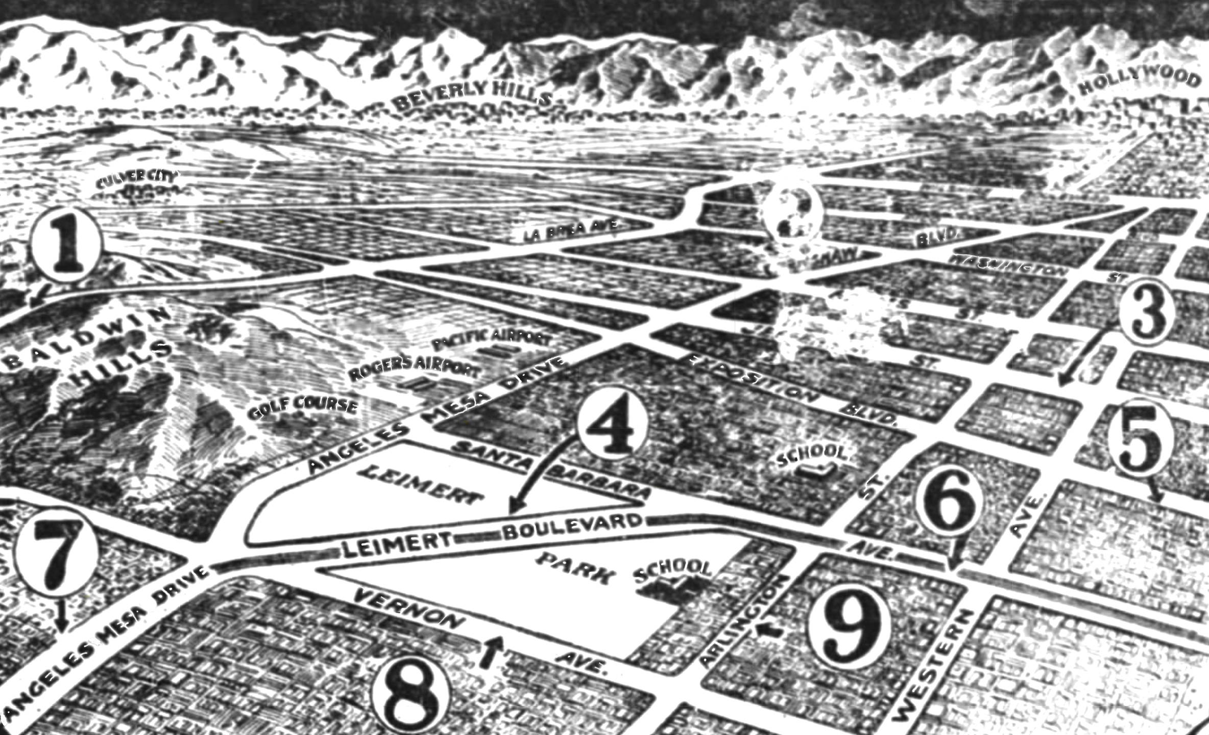
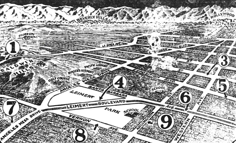
Description: Caption from the Los Angeles Times of March 20, 1927: Section to be Enhanced by Street Improvements Transformation of District Will be Affected The map above shows in graphic manner the nine important developments now under way, which will affect a transformation of the entire southwest section of Los Angeles. They are as follows: (1) La Brea avenue is to extend, 100 feet wide, from Jefferson street through the Baldwin Hills to Inglewood; (2) Crenshaw Boulevard, ninety feet wide, is now complete from Wilshire to Adamss; (3) Jefferson Boulevard, from Ninth avenue to Cochran, is now under construction; (4) Leimert Boulevard 133 feet wide between property lines, will connect Santa Barbara avenue with Angeles Mesa at Vernon; (5) Exposition Boulevard is to be opened and widened to fifty feet on each side of the Pacific Electric right of way from Main street to Angeles Mesa Drive; (6) Plans have been approved for the improvement of Santa Barbara avenue 100 feet wide from Alameda street to Angeles Mesa Drive; (7) Angeles Mesa Drive is to be paved and widened with two fifty-seven and one-half feet road ways, from Vernon to Seventy-ninth street; (8) Vernon avenue is to be widened to eighty feet; (9) Arlington avenue is being paved and widened to forty-six feet from Jefferson to Forty-eighth street. Will be used in Leimert Park, Los Angeles and other pages.
Title: 1927 map of Southwest Los Angeles, California
Credit: https://www.newspapers.com/image/380417699/
Author: Los Angeles Times
Usage Terms: Public domain in the United States
License: PD-US
License Link: //en.wikipedia.org/wiki/File:1927_map_of_Southwest_Los_Angeles,_California.jpg
Image usage
The following image is a duplicate of this image (more details):
The following page links to this image:
