
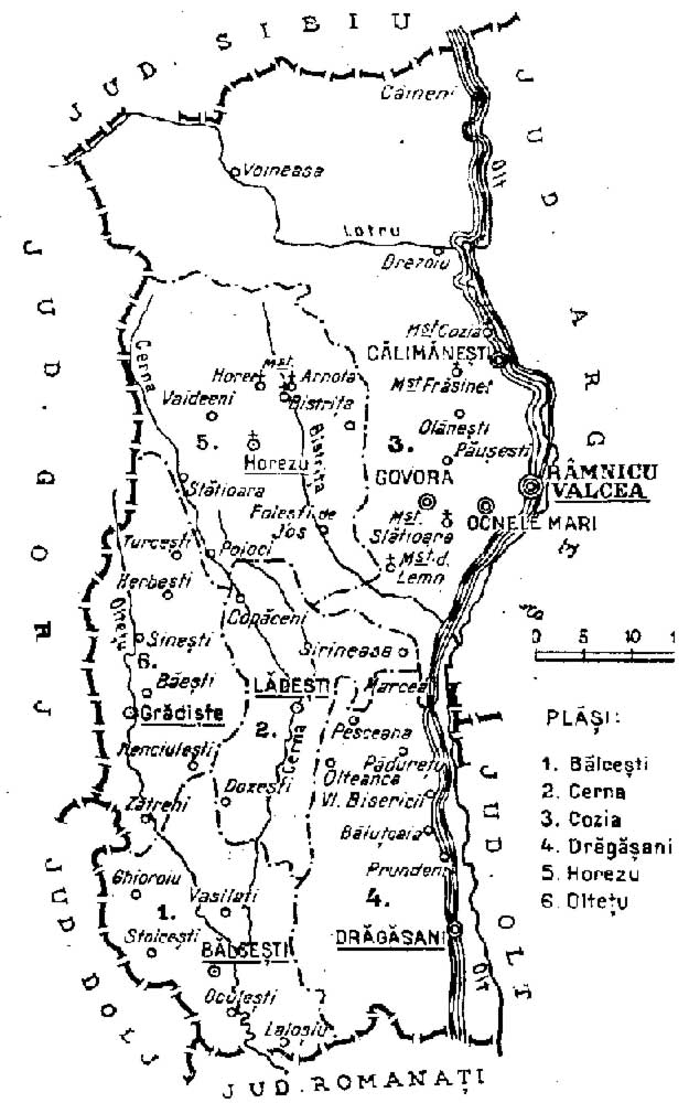
Image: 1938 map of interwar county Valcea
Size of this preview: 375 × 600 pixels. Other resolutions: 150 × 240 pixels | 625 × 1,000 pixels.
Original image (625 × 1,000 pixels, file size: 91 KB, MIME type: image/jpeg)
Description: Map of Vâlcea interwar county, Kingdom of Romania (1938).
Title: 1938 map of interwar county Valcea
Credit: This map was published in Dimitrie Gusti, Constantin Orghidan, Mircea Vulcănescu, Virgiliu Leonte – «Enciclopedia României» (Imprimeria Națională, București, 1938-1943). This file is found at romaniainterbelica.memoria.ro
Author: «Enciclopedia României». Uploaded by Musichistory2009.
Usage Terms: Public domain
License: Public domain
Attribution Required?: No
Image usage
The following page links to this image:

All content from Kiddle encyclopedia articles (including the article images and facts) can be freely used under Attribution-ShareAlike license, unless stated otherwise.