
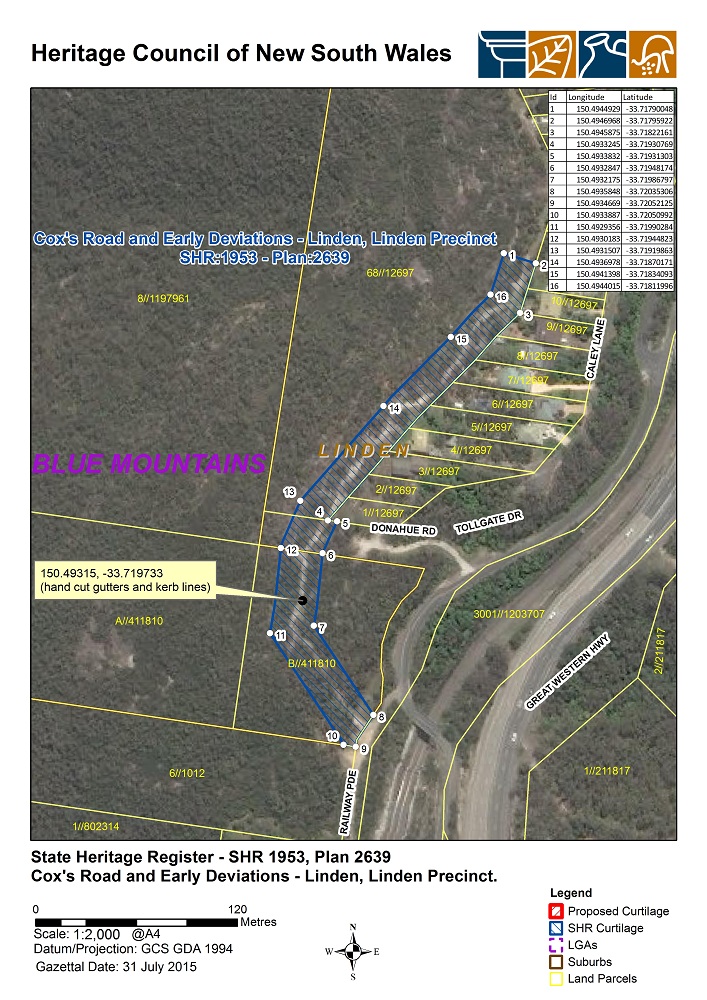
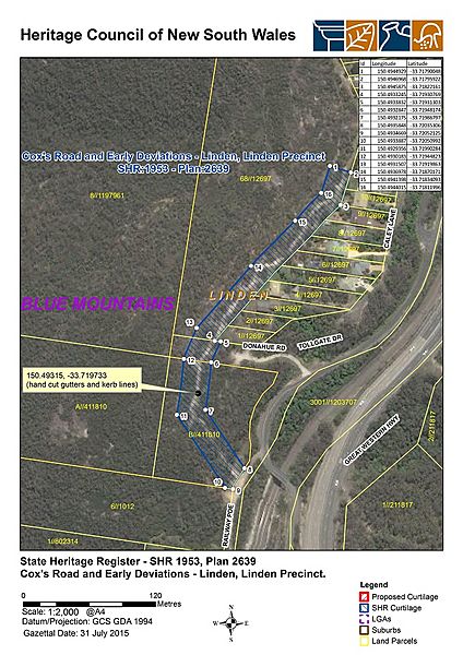
Image: 1953 - Cox's Road and Early Deviations - Linden, Linden Precinct - SHR Plan No 2639 (5062552b100)
Description: Cox's Road and Early Deviations - Linden, Linden Precinct: SHR Plan No 2639: Curtilage or boundary for Cox's Road and Early Deviations: Linden, Linden Precinct - State Heritage Register listing - satellite view
Title: 1953 - Cox's Road and Early Deviations - Linden, Linden Precinct - SHR Plan No 2639: Curtilage or boundary for Cox's Road and Early Deviations: Linden, Linden Precinct - State Heritage Register listing - satellite view (5062552b100)
Credit: https://www.environment.nsw.gov.au/maritimeheritageapp/resources/Heritage/shi/506/5062552b100.jpg
Author: Heritage Division
Permission: This file is licensed under the Creative Commons Attribution 4.0 International license. You are free: to share – to copy, distribute and transmit the work to remix – to adapt the work Under the following conditions: attribution – You must give appropriate credit, provide a link to the license, and indicate if changes were made. You may do so in any reasonable manner, but not in any way that suggests the licensor endorses you or your use. https://creativecommons.org/licenses/by/4.0 CC BY 4.0 Creative Commons Attribution 4.0 truetrue
Usage Terms: Creative Commons Attribution 4.0
License: CC BY 4.0
License Link: https://creativecommons.org/licenses/by/4.0
Attribution Required?: Yes
Image usage
The following page links to this image:

.jpg)