
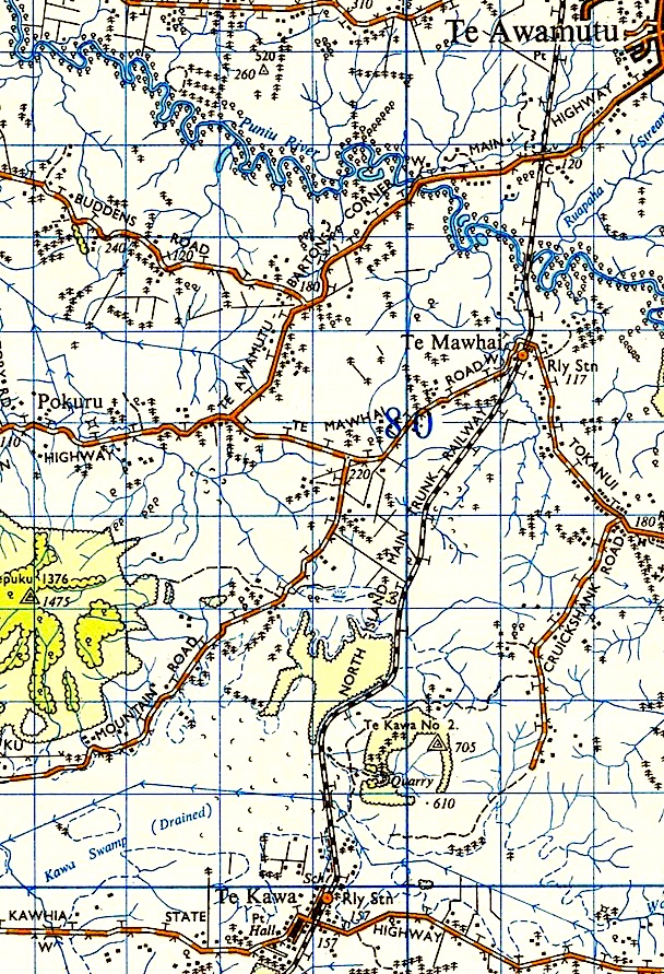
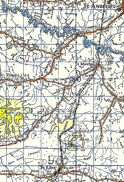
Image: 1955 Te Awamutu - Te Mawhai - Te Kawa North Island Main Trunk map
Size of this preview: 409 × 599 pixels. Other resolutions: 164 × 240 pixels | 608 × 891 pixels.
Original image (608 × 891 pixels, file size: 404 KB, MIME type: image/jpeg)
Description: 1955 one inch to one mile map (Source- Land Information New Zealand (LINZ) and licensed by LINZ for re-use under the Creative Commons Attribution 3.0 New Zealand licence)
Title: 1955 Te Awamutu - Te Mawhai - Te Kawa North Island Main Trunk map
Credit: LINZ 1955
Author: Lands and Survey
Usage Terms: Creative Commons Attribution-Share Alike 3.0
License: CC BY-SA 3.0
License Link: https://creativecommons.org/licenses/by-sa/3.0
Attribution Required?: Yes
Image usage
The following 2 pages link to this image:

All content from Kiddle encyclopedia articles (including the article images and facts) can be freely used under Attribution-ShareAlike license, unless stated otherwise.