
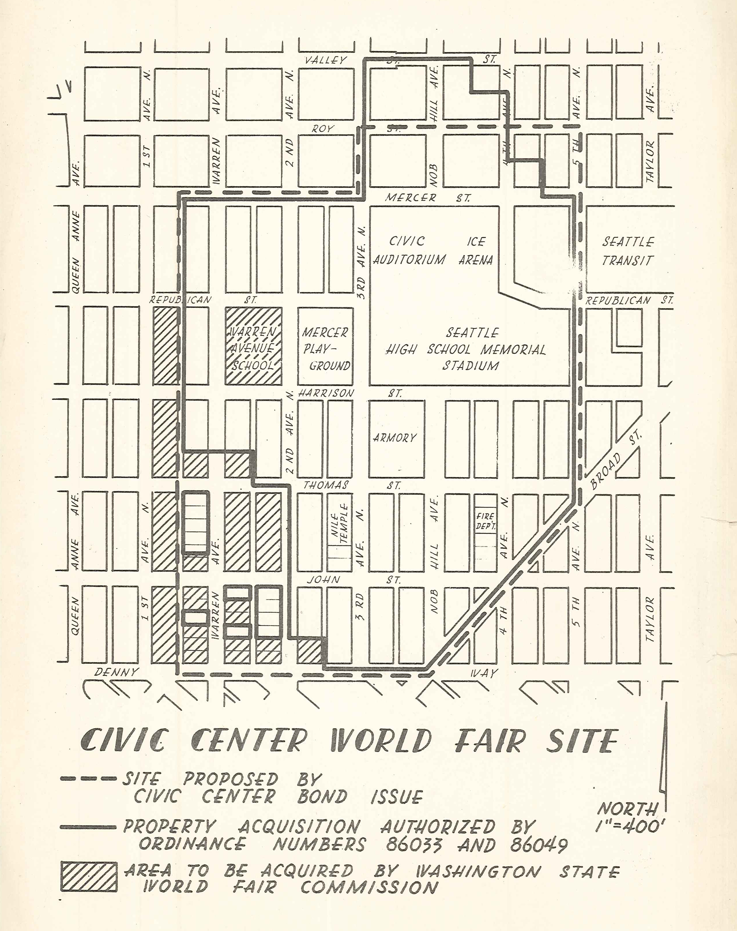
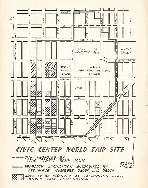
Image: 1960 map of what became Seattle Center
Size of this preview: 475 × 600 pixels. Other resolutions: 190 × 240 pixels | 2,556 × 3,228 pixels.
Original image (2,556 × 3,228 pixels, file size: 3.29 MB, MIME type: image/jpeg)
Description: 1960 map of what became the grounds of the Century 21 Exposition and later Seattle Center.
Title: 1960 map of what became Seattle Center
Credit: Seattle Municipal Archives
Author: Seattle Municipal Archives from Seattle, WA
Usage Terms: Creative Commons Attribution 2.0
License: CC BY 2.0
License Link: https://creativecommons.org/licenses/by/2.0
Attribution Required?: Yes
Image usage
The following page links to this image:

All content from Kiddle encyclopedia articles (including the article images and facts) can be freely used under Attribution-ShareAlike license, unless stated otherwise.