
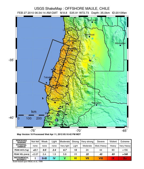
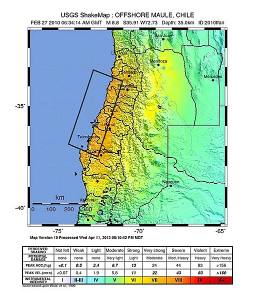
Image: 2010 Maule earthquake intensity USGS
Size of this preview: 510 × 599 pixels. Other resolutions: 204 × 240 pixels | 612 × 719 pixels.
Original image (612 × 719 pixels, file size: 110 KB, MIME type: image/jpeg)
Description: Shake map of the magnitude 8.8 earthquake offshore Chile on February 27, 2010. Epicenter marked at star. Seventh version of the map, realized by USGS on 5 March 2010 at 03:00:13 AM MST.
Title: 2010 Maule earthquake intensity USGS
Credit: USGS
Author: USGS
Usage Terms: Public domain
License: Public domain
Attribution Required?: No
Image usage
The following page links to this image:

All content from Kiddle encyclopedia articles (including the article images and facts) can be freely used under Attribution-ShareAlike license, unless stated otherwise.