
Image: 2011Sendai-NOAA-Energylhvpd9-05
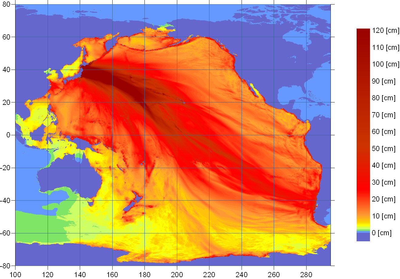
Description: Ocean energy distribution forecast map for the 2011 Sendai earthquake from the U.S. NOAA
Title: 2011Sendai-NOAA-Energylhvpd9-05
Credit: wcatwc.arh.noaa.gov (direct image URL [1]) There is a similar image here with a caption; "contours of forecasted maximum wave amplitudes [cm], detailing tsunami energy propagation". Presumably the scale simply stops at 120cm; but at the coasts the wave rises much higher.
Author: West Coast & Alaska Tsunami Warning Center, National Oceanic and Atmospheric Administration
Permission: This image is in the public domain because it contains materials that originally came from the U.S. National Oceanic and Atmospheric Administration, taken or made as part of an employee's official duties.
Usage Terms: Public domain
License: Public domain
Attribution Required?: No
Image usage
The following page links to this image:
