
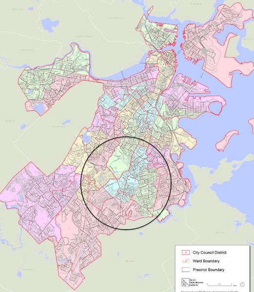
Image: 2012 District 4 Boston City Council electoral districts map

Size of this preview: 521 × 599 pixels. Other resolutions: 209 × 240 pixels | 607 × 698 pixels.
Original image (607 × 698 pixels, file size: 564 KB, MIME type: image/jpeg)
Description: Boston City Council District 4 indicated on map of Boston "City Council Districts. 2012 Approved Plan. Last update 12/2012. 34 x 44"." Massachusetts, USA.
Title: 2012 District 4 Boston City Council electoral districts map
Credit: Boston Redevelopment Authority / http://www.bostonredevelopmentauthority.org/research-maps/maps-and-gis/electoral-maps
Author: City of Boston
Usage Terms: Creative Commons Attribution 3.0
License: CC BY 3.0
License Link: http://creativecommons.org/licenses/by/3.0
Attribution Required?: Yes
Image usage
There are no pages that link to this image.

All content from Kiddle encyclopedia articles (including the article images and facts) can be freely used under Attribution-ShareAlike license, unless stated otherwise.