
Image: 2013-P09-ZD-b
Size of this preview: 625 × 599 pixels. Other resolutions: 250 × 240 pixels | 1,219 × 1,169 pixels.
Original image (1,219 × 1,169 pixels, file size: 978 KB, MIME type: image/jpeg)
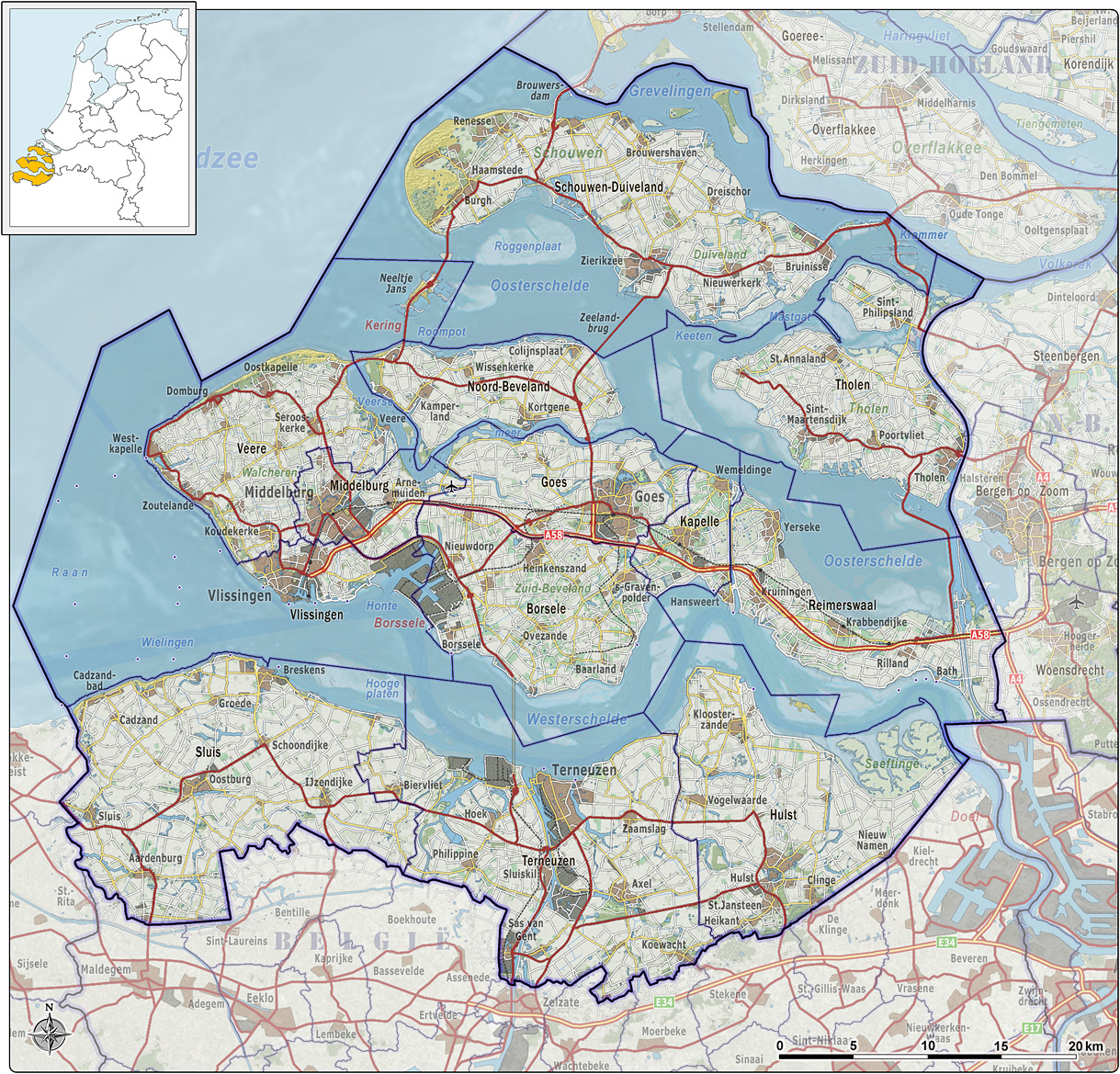
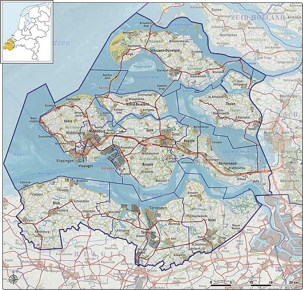
Description: Kaart van de provincie Zeeland per 1-1-2013, met indeling van gemeenten en impressie van het landschap.
Title: 2013-P09-ZD-b
Credit: Own work
Author: Janwillemvanaalst
Usage Terms: Creative Commons Attribution-Share Alike 3.0
License: CC BY-SA 3.0
License Link: http://creativecommons.org/licenses/by-sa/3.0
Attribution Required?: Yes
Image usage
The following page links to this image:

All content from Kiddle encyclopedia articles (including the article images and facts) can be freely used under Attribution-ShareAlike license, unless stated otherwise.