
Image: 2015 World Urbanization Map
Size of this preview: 800 × 317 pixels. Other resolutions: 320 × 127 pixels | 3,152 × 1,248 pixels.
Original image (3,152 × 1,248 pixels, file size: 156 KB, MIME type: image/png)
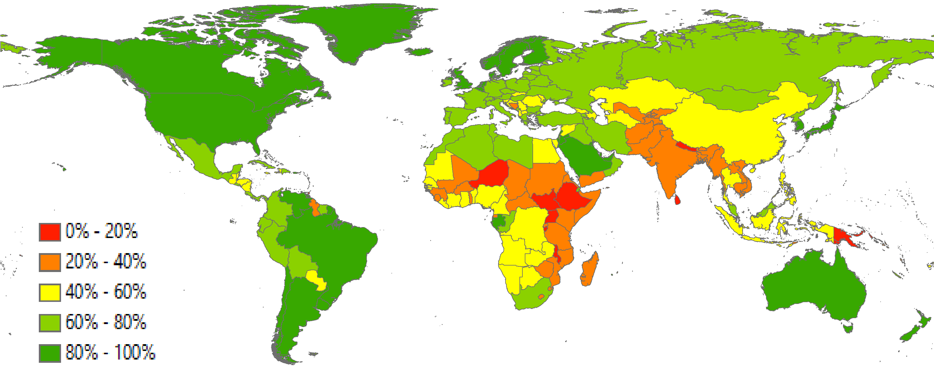
Description: The percentage of a country's population that lives in urban areas.
Title: 2015 World Urbanization Map
Credit: Own work, based on United Nations, Department of Economic and Social Affairs, Population Division (2014). World Urbanization Prospects: The 2014 Revision, CD-ROM Edition
Author: Akantamn
Usage Terms: Creative Commons Attribution-Share Alike 4.0
License: CC BY-SA 4.0
License Link: http://creativecommons.org/licenses/by-sa/4.0
Attribution Required?: Yes
Image usage
The following page links to this image:

All content from Kiddle encyclopedia articles (including the article images and facts) can be freely used under Attribution-ShareAlike license, unless stated otherwise.