
Image: 2016 Kaikoura Earthquake ShakeMap
Size of this preview: 473 × 599 pixels. Other resolutions: 189 × 240 pixels | 750 × 950 pixels.
Original image (750 × 950 pixels, file size: 531 KB, MIME type: image/jpeg)
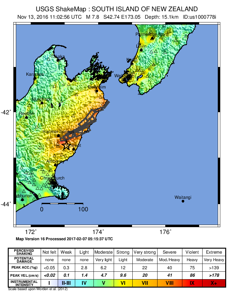
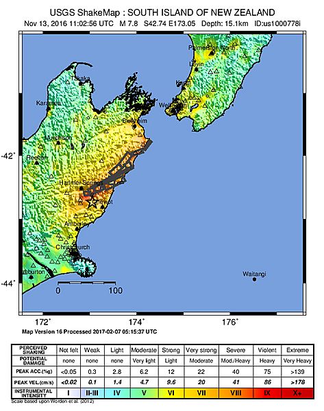
Description: ShakeMap from the USGS for the 2016 North Canterbury earthquake in New Zealand
Title: 2016 Kaikoura Earthquake ShakeMap
Credit: http://earthquake.usgs.gov/earthquakes/eventpage/us1000778i#shakemap
Author: USGS
Usage Terms: Public domain
License: Public domain
Attribution Required?: No
Image usage
The following 2 pages link to this image:

All content from Kiddle encyclopedia articles (including the article images and facts) can be freely used under Attribution-ShareAlike license, unless stated otherwise.