
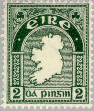
Image: 2d Map of Ireland- first Irish postage stamp
No higher resolution available.
2d_Map_of_Ireland-_first_Irish_postage_stamp.jpg (331 × 391 pixels, file size: 31 KB, MIME type: image/jpeg)
Description: 2d 'Map of Ireland' postage stamp first issued 6 December 1922
Title: 2d Map of Ireland- first Irish postage stamp
Credit: Europeanstamps.net
Author: Department of Posts and Telegraphs
Permission: Public domain (all Irish Government copyright terminates 50 years after the work was made according to the appropriate Irish law)
Usage Terms: Public domain
License: Public domain
Attribution Required?: No
Image usage
The following 2 pages link to this image:

All content from Kiddle encyclopedia articles (including the article images and facts) can be freely used under Attribution-ShareAlike license, unless stated otherwise.