
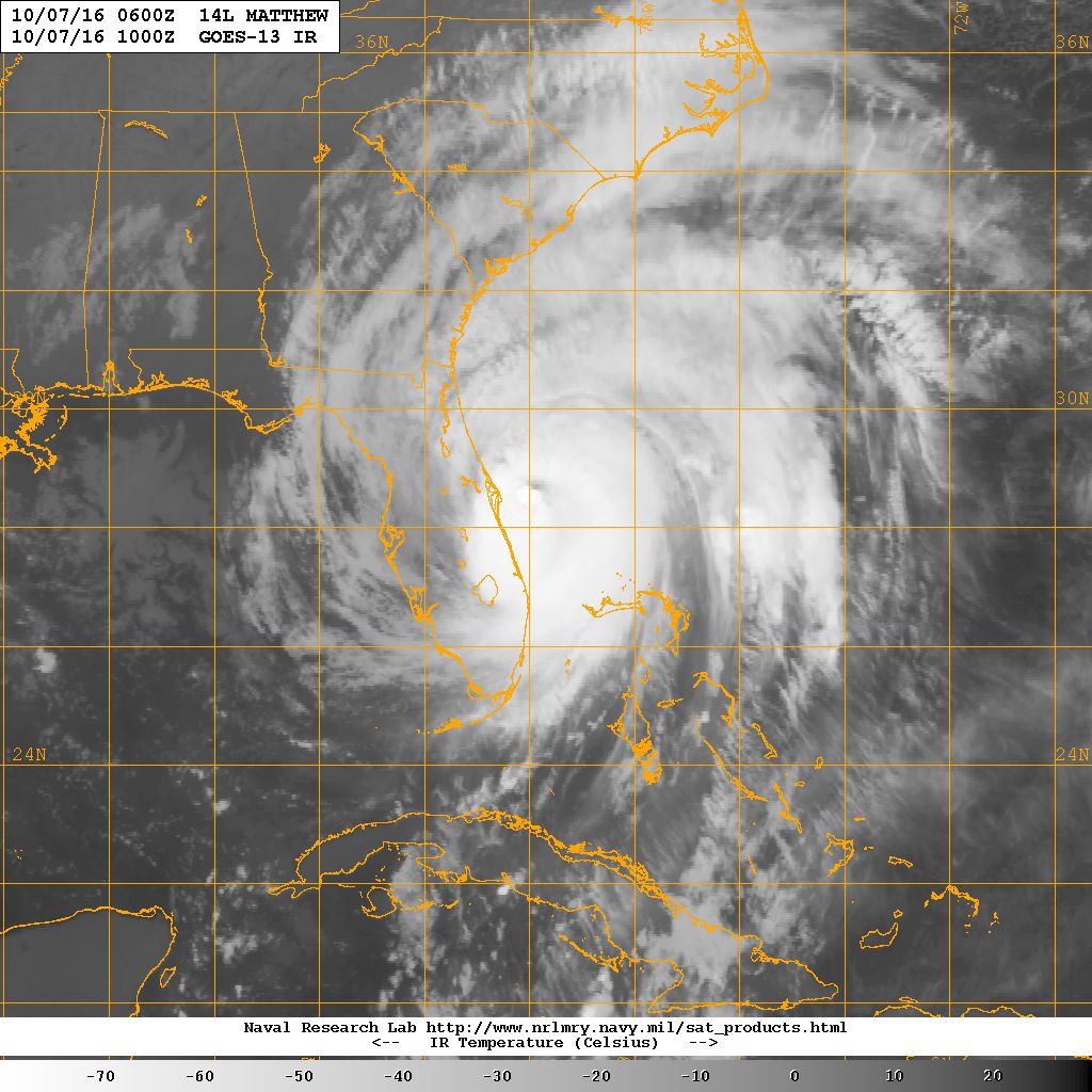
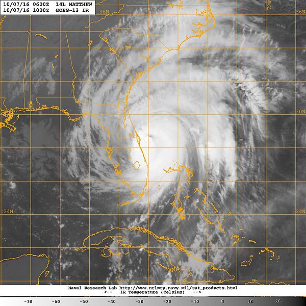
Image: A GOES-13 satellite image of Hurricane Matthew along the Florida coastline. (30170273245)
Description: ATLANTIC OCEAN (Oct. 7, 2016) A GOES-13 satellite image of Hurricane Matthew along the Florida coastline. At 500 AM EDT (0900 UTC), the eye of Matthew was located near latitude 28.2 North, longitude 80.0 West. It is moving toward the north-northwest near 13 mph (20 km/h), and this general motion is expected to continue today. A turn toward the north is expected tonight or Saturday. On the forecast track, the center of Matthew will be moving near or over the east coast of the Florida peninsula through tonight, and near or over the coasts of Georgia and South Carolina on Saturday. Maximum sustained winds are near 120 mph (195 km/h) with higher gusts. Matthew is a category 3 hurricane on the Saffir-Simpson Hurricane Wind Scale. Although weakening is forecast during the next 48 hours, Matthew is expected to be a category 3 hurricane as it moves near the coast of Florida today. (U.S. Navy photo/Released) 161007-N-N0101-001 Join the conversation: www.navy.mil/viewGallery.asp www.facebook.com/USNavy www.twitter.com/USNavy navylive.dodlive.mil pinterest.com plus.google.com
Title: A GOES-13 satellite image of Hurricane Matthew along the Florida coastline. (30170273245)
Credit: A GOES-13 satellite image of Hurricane Matthew along the Florida coastline.
Author: Official U.S. Navy Page from United States of America U.S. Navy photo/U.S. Navy
Permission: Flinfo has extracted the license below from the metadata of the image (tag "IPTC:Caption-Abstract" contained "U.S. Navy photo"). The license visible at Flickr was "Attribution License".
Usage Terms: Public domain
License: Public domain
Attribution Required?: No
Image usage
The following page links to this image:

.jpg)