
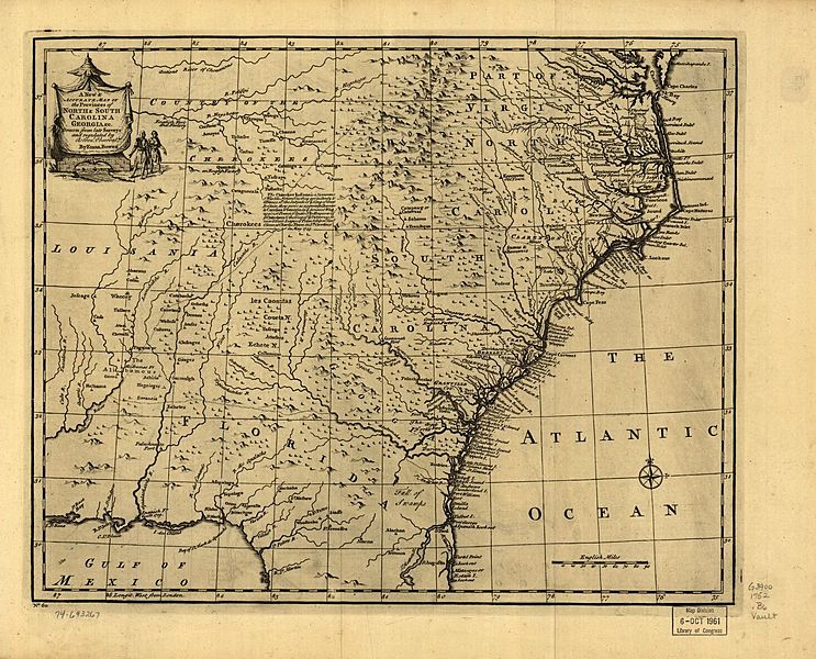
Image: A new accurate map of the provinces of North & South Carolina, Georgia, Florida, and Louisiana in 1752

Size of this preview: 743 × 600 pixels. Other resolutions: 298 × 240 pixels | 1,466 × 1,183 pixels.
Original image (1,466 × 1,183 pixels, file size: 434 KB, MIME type: image/jpeg)
Description: Scale ca. 1:2,900,000. Relief shown pictorially. "No. 60." From the author (Bowen, Emanuel, -1767): A complete atlas or distinct view of the known world. [London, 1752]
Usage Terms: Public domain
Image usage
The following page links to this image:

All content from Kiddle encyclopedia articles (including the article images and facts) can be freely used under Attribution-ShareAlike license, unless stated otherwise.