
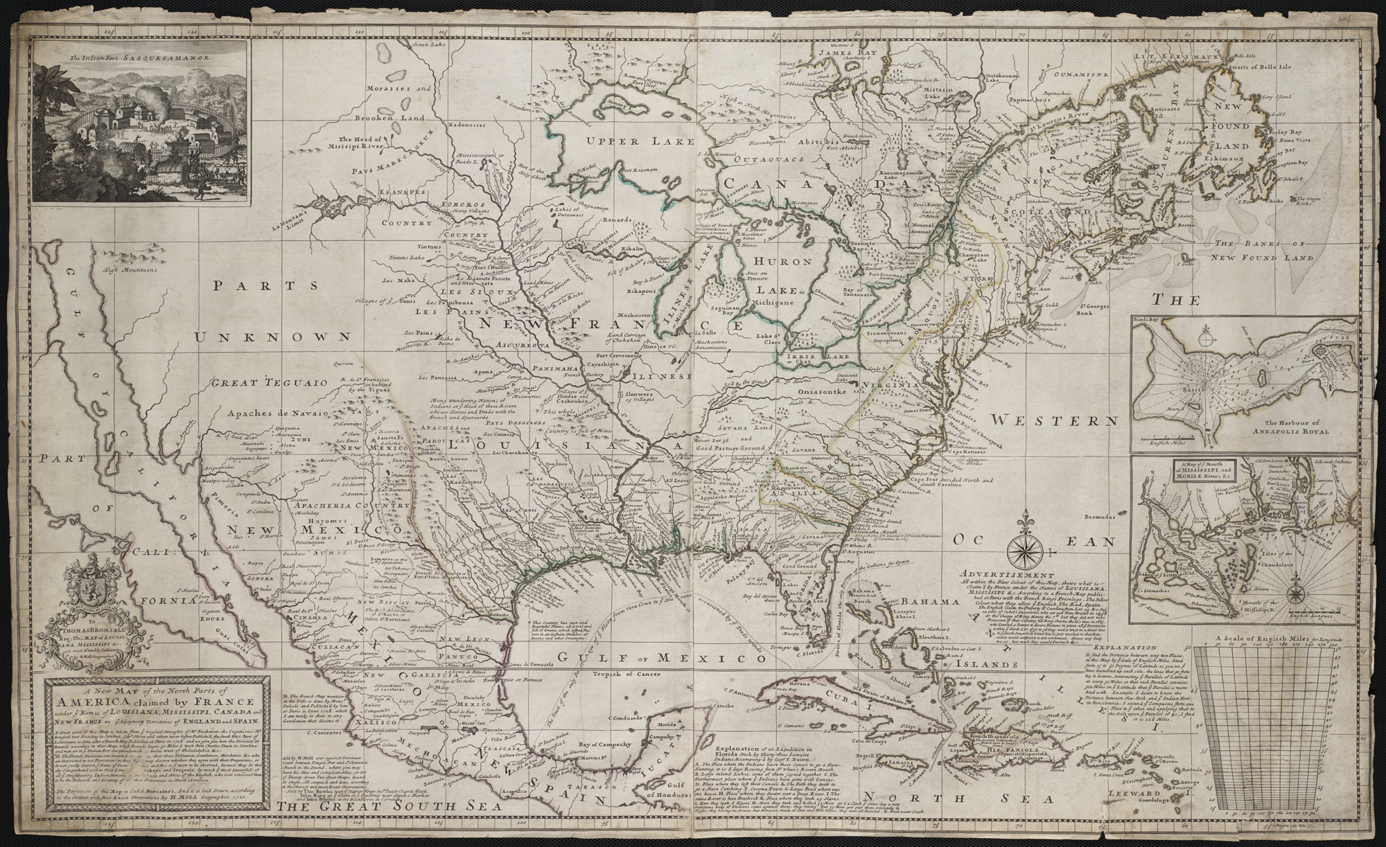
Image: A new map of the north parts of America claimed by France under ye names of Louisiana... (2674873145)
Description: Zoom into this map at maps.bpl.org. Author: Moll, Herman Publisher: Sold by H. Moll Date: [1720] Location: North America Scale: Scale ca. 1:7,000,000 ; Call Number: G3300 1720.M6 In 1720, London geographer and mapmaker, Herman Moll, published this map focusing on France's North American possessions. In a message below the title, he warned his British audience of French encroachment on neighboring English interests in the region and urged them to preserve old friendships with the Iroquois and Cherokees. The depiction of the Southeast was based on recent English surveys, particularly those of Richard Berresford and Capt. Thomas Naime. However, the Southwest, where California is depicted as island, was based on outdated information that was mistakenly accepted by European mapmakers from the mid-17th century until the early 18th century.
Title: A new map of the north parts of America claimed by France under ye names of Louisiana... (2674873145)
Credit: A new map of the north parts of America claimed by France under ye names of Louisiana[...]
Author: http://maps.bpl.org
Usage Terms: Creative Commons Attribution 2.0
License: CC BY 2.0
License Link: https://creativecommons.org/licenses/by/2.0
Attribution Required?: Yes
Image usage
The following 3 pages link to this image:

.jpg)