
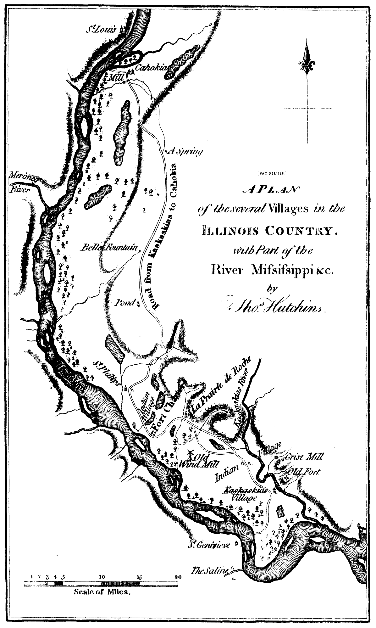
Image: A plan of the several villages in the illinois country
Size of this preview: 359 × 599 pixels. Other resolutions: 144 × 240 pixels | 1,196 × 1,996 pixels.
Original image (1,196 × 1,996 pixels, file size: 198 KB, MIME type: image/png)
Description: Map of the Several Villages in the Illinois Country with Part of the River Mississippi &c. (facsimile) by Thomas Hutchins. Printed in Parkman, Francis. The Conspiracy of Pontiac and the Indian War after the Conquest of Canada, Vol. I, 1851. 6th ed., 1870. Project Gutenberg, 2012. http://www.gutenberg.org/files/39253/39253-h/39253-h.htm
Title: A plan of the several villages in the illinois country
Credit: http://www.gutenberg.org/files/39253/39253-h/39253-h.htm
Author: Thomas Hutchins
Usage Terms: Public domain
License: Public domain
Attribution Required?: No
Image usage
The following 6 pages link to this image:

All content from Kiddle encyclopedia articles (including the article images and facts) can be freely used under Attribution-ShareAlike license, unless stated otherwise.