
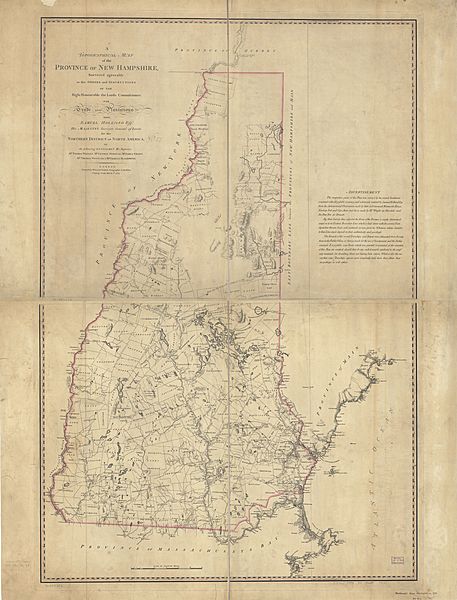
Image: A topographical map of the Province of New Hampshire, LOC 74692582

Description: Scale ca. 1:260,000. Hand colored. LC copy annotated in upper left beside title, "No. 57" and in lower right margin "Holland's New Hampshire, 1784. No. 42." Relief shown by hachures. Shows township and patent boundaries. "The respective parts of this plan were survey'd by the several gentlemen concerned with all possible accuracy, and afterwards rectified by Samuel Holland ... " Copy 3 LC copy sectioned and mounted on cloth backing Copy 3 LC copy annotated on verso at the top of attached cover: New Hampshire. 1784 LC Maps of North America, 1750-1789, 873 Available also through the Library of Congress Web site as a raster image. Vault AACR2
Title: A topographical map of the Province of New Hampshire, LOC 74692582
Credit: https://www.loc.gov/item/74692582/
Author: Holland, Samuel; Faden, William
Permission: This map is available from the United States Library of Congress's Geography & Map Division under the digital ID g3740.ar087301. This tag does not indicate the copyright status of the attached work. A normal copyright tag is still required. See Commons:Licensing for more information.
Usage Terms: Public domain
License: Public domain
Attribution Required?: No
Image usage
The following page links to this image:
