
Image: Abaco Islands 15ft 4p572 shaded
Size of this preview: 474 × 599 pixels. Other resolutions: 190 × 240 pixels | 1,651 × 2,086 pixels.
Original image (1,651 × 2,086 pixels, file size: 610 KB, MIME type: image/png)
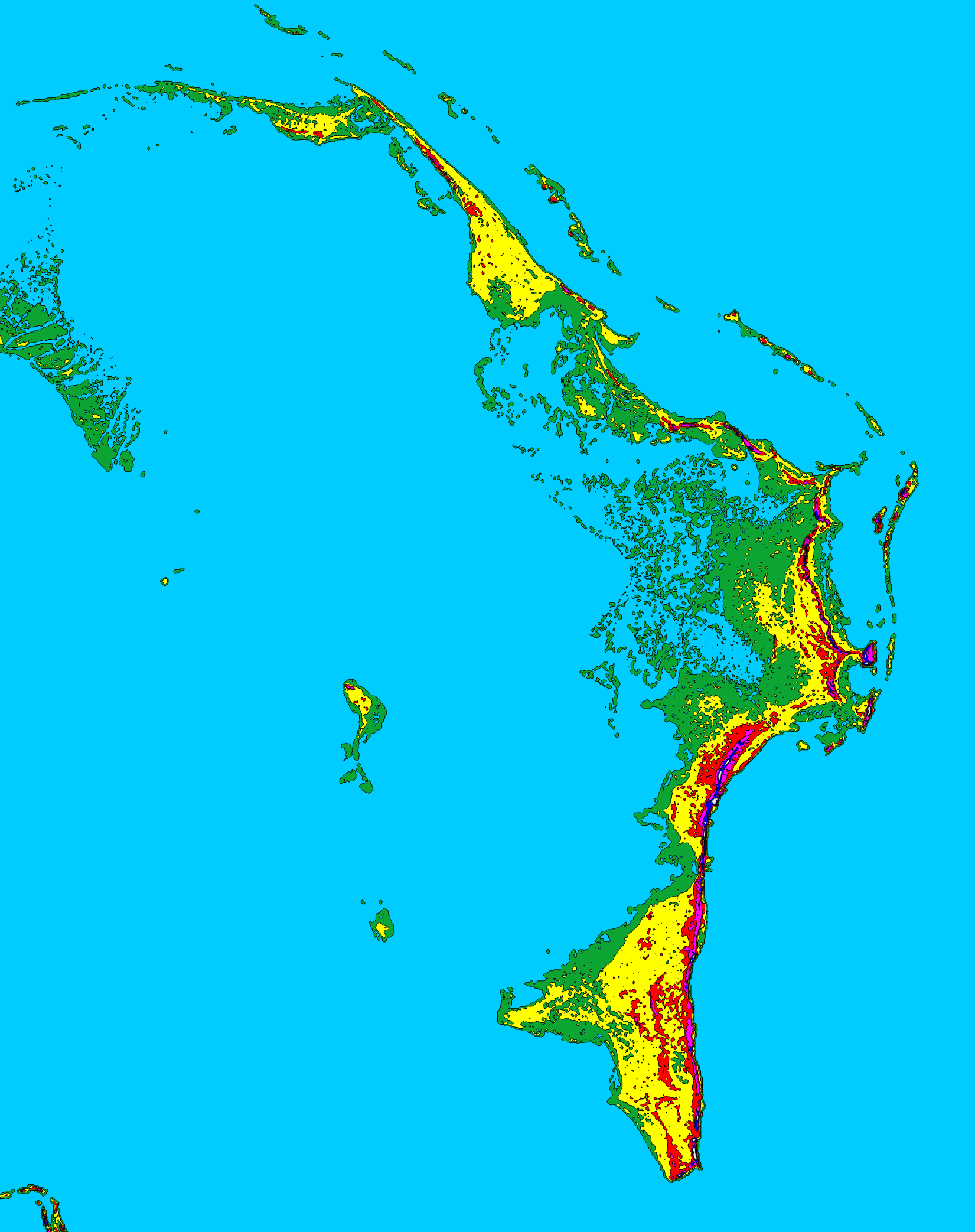
Description: Topographic map of the Abaco Islands, Bahamas shaded at 15 foot (4.572 meter) contour intervals. MAP KEY Light Blue: 0 ft (0.0 m) Green: 0-15 ft (0.0-4.6 m) Yellow: 15-30 ft (4.6-9.1 m) Red: 30-45 ft (9.1-13.7 m) Violet: 45-60 ft (13.7-18.3 m) Blue: 60-75 ft (18.3-22.9 m) White: 75+ ft (22.9+ m) Map created with SRTM3 digital elevation data (http://dds.cr.usgs.gov/srtm/version2_1/SRTM3/). Resolution is ~90 meters.
Title: Abaco Islands 15ft 4p572 shaded
Credit: Own work
Author: Lithium6ion
Usage Terms: Public domain
License: Public domain
Attribution Required?: No
Image usage
The following page links to this image:

All content from Kiddle encyclopedia articles (including the article images and facts) can be freely used under Attribution-ShareAlike license, unless stated otherwise.