
Image: Aberdeenshire UK location map

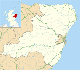
Description: Blank map of Aberdeenshire, UK with the following information shown: Administrative borders Coastline, lakes and rivers Roads and railways Urban areas Equirectangular map projection on WGS 84 datum, with N/S stretched 180% Geographic limits: West: 3.85W East: 1.70W North: 57.75N South: 56.70N
Title: Aberdeenshire UK location map
Credit: Ordnance Survey OpenData. Administrative borders and coastline data from Boundary-Line product. All other geographic data from Meridian 2 product. Inset derived from Inset derived from File:Scotland location map.svg by NordNordWest.
Author: Nilfanion, created using Ordnance Survey data
Permission: This file is licensed under the Creative Commons Attribution-Share Alike 3.0 Unported license. Attribution: Contains Ordnance Survey data © Crown copyright and database right You are free: to share – to copy, distribute and transmit the work to remix – to adapt the work Under the following conditions: attribution – You must attribute the work in the manner specified by the author or licensor (but not in any way that suggests that they endorse you or your use of the work). share alike – If you alter, transform, or build upon this work, you may distribute the resulting work only under the same or similar license to this one. http://creativecommons.org/licenses/by-sa/3.0 CC BY-SA 3.0 Creative Commons Attribution-Share Alike 3.0 truetrue
Usage Terms: Creative Commons Attribution-Share Alike 3.0
License: CC BY-SA 3.0
License Link: http://creativecommons.org/licenses/by-sa/3.0
Attribution Required?: Yes
Image usage
The following 82 pages link to this image:
- Aberchirder
- Alford, Aberdeenshire
- Aquhorthies stone circle
- Auld Bourtreebush
- Avochie Castle
- Ballater
- Balquhain Castle
- Banchory
- Banff, Aberdeenshire
- Banff and Macduff
- Bellabeg
- Blackburn, Aberdeenshire
- Boddam, Aberdeenshire
- Braemar
- Braemar Castle
- Chapel of Garioch
- Cluny Crichton Castle
- Coull Castle
- Crathes Castle
- Crathie Kirk
- Cruden Bay
- Cullerlie stone circle
- Dunnideer stone circle
- Dunnottar Castle
- Durris Castle
- Easter Clune Castle
- Ellon, Aberdeenshire
- Fedderate Castle
- Fordyce Castle
- Forest of Birse
- Forvie National Nature Reserve
- Foveran Castle
- Fraserburgh
- Fraserburgh Old Parish Church
- Freefield Castle
- Gartly Castle
- Gight
- Glen Tanar
- Glenkindie Castle
- Harthill Castle
- Huntly
- Huntly Castle
- Inchdrewer Castle
- Insch
- Inverbervie
- Inverugie Castle
- Inverurie
- Inverurie Hospital
- Kemnay
- Kemnay, Aberdeenshire
- Kennethmont
- Kinnaird Head
- Kinord Castle
- Kintore, Aberdeenshire
- Laurencekirk
- Leslie Castle
- Loanhead of Daviot stone circle
- Macduff, Aberdeenshire
- Migvie Castle
- Muir of Dinnet
- Old Deer
- Old Parish Church, Peterhead
- Old St Peter's Church, Peterhead
- Peterhead
- Pitcaple
- Portlethen
- Portsoy
- RNAS Longside
- Reform Monument
- St. Peter's Episcopal Church, Peterhead
- St Cyrus National Nature Reserve
- Statue of Field Marshal Keith
- Stonehaven
- Strichen stone circle
- Stuartfield
- Sunhoney
- Tillyhilt Castle
- Tolquhon Castle
- Turriff
- Westhill
- Whitehill Wood, Aberdeenshire
- Template:Location map Scotland Aberdeenshire
