
Image: Addis Ababa (district map)
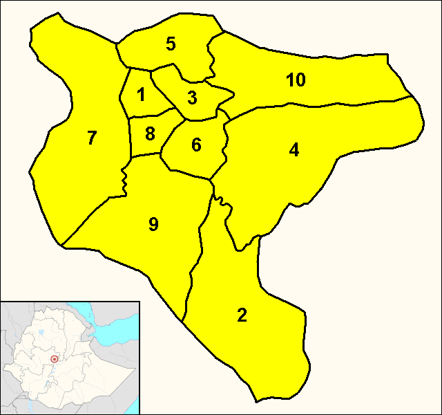
Description: Map of the 10 districts (subcities) of Addis Ababa. 1: Addis Ketema - 2: Akaky Kaliti - 3: Arada - 4: Bole - 5: Gullele - 6: Kirkos - 7: Kolfe Keranio - 8: Lideta - 9: Nifas Silk-Lafto - 10: Yeka.
Title: Addis Ababa (district map)
Credit: Own work. The map was derived following Google Maps, the datas about the districts have been found on the Addis Ababa official website (see the section "Sub Cities"). The little Ethiopian map showing Addis Ababa position derives from the File:Addis Ababa in Ethiopia (special marker).svg by TUBS.
Author: Dэя-Бøяg
Usage Terms: Creative Commons Attribution-Share Alike 3.0
License: CC-BY-SA-3.0
License Link: http://creativecommons.org/licenses/by-sa/3.0/
Attribution Required?: Yes
Image usage
The following page links to this image:

.png)