
Image: Adelaide trammap 1950s
Size of this preview: 493 × 600 pixels. Other resolutions: 197 × 240 pixels | 715 × 870 pixels.
Original image (715 × 870 pixels, file size: 53 KB, MIME type: image/png)
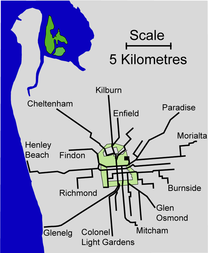
Description: Map of the Adelaide electric tramlines at maximum extent (somewhere between 1952 and 1958). Self created from a 1952 MTT tram map and maps at the St Kilda tram museum Originally uploaded to en:wikipedia then re-uploaded here. Created by Peripitus
Title: Adelaide trammap 1950s
Credit: No machine-readable source provided. Own work assumed (based on copyright claims).
Author: No machine-readable author provided. Peripitus assumed (based on copyright claims).
Usage Terms: Creative Commons Attribution-Share Alike 3.0
License: CC-BY-SA-3.0
License Link: http://creativecommons.org/licenses/by-sa/3.0/
Attribution Required?: Yes
Image usage
The following page links to this image:

All content from Kiddle encyclopedia articles (including the article images and facts) can be freely used under Attribution-ShareAlike license, unless stated otherwise.