
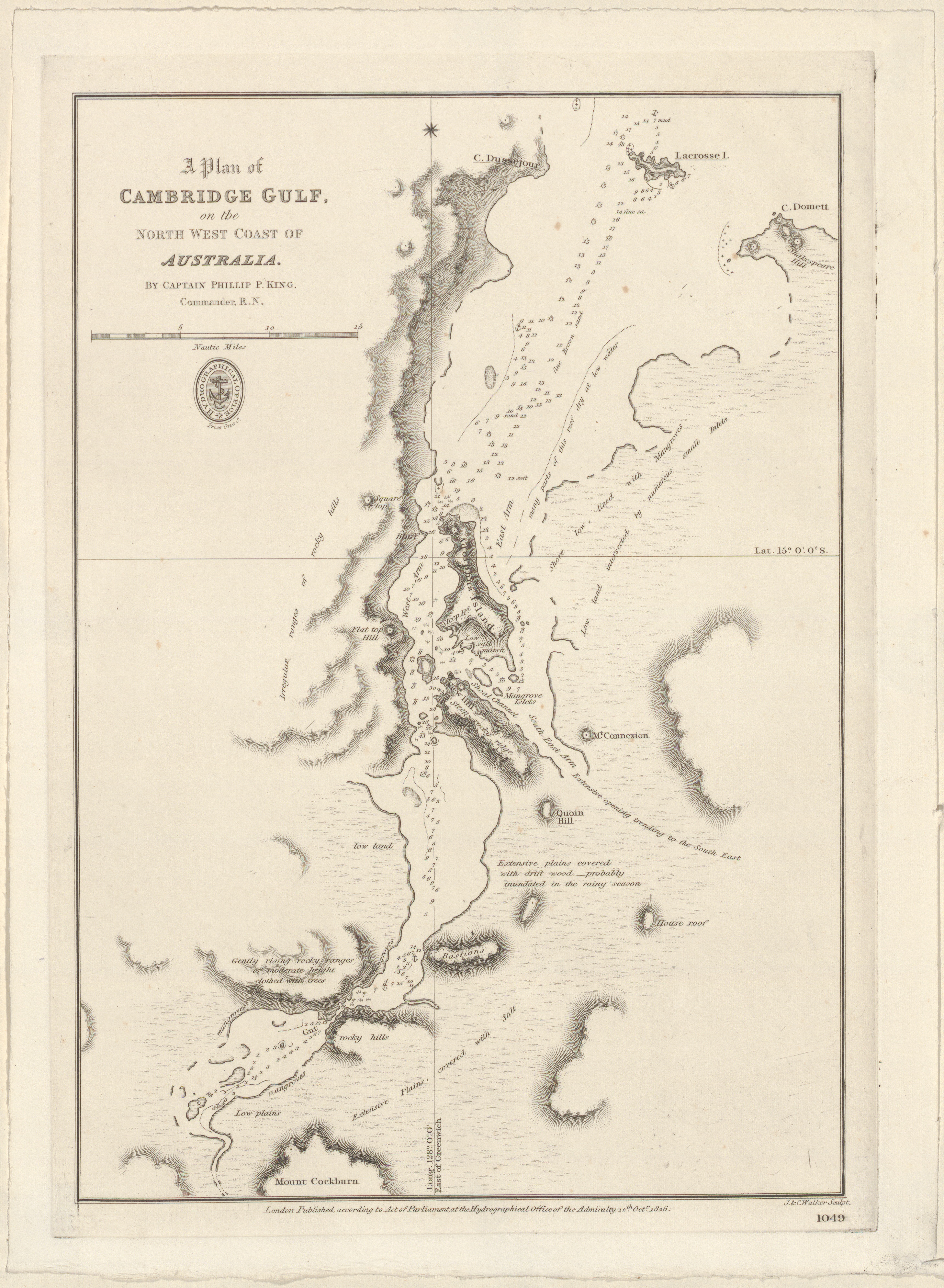
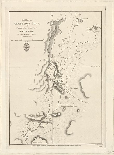
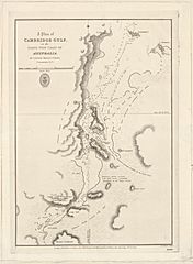
Image: Admiralty Chart No 1049 A plan of Cambridge Gulf on the north west coast of Australia, Published 1826
Size of this preview: 439 × 599 pixels. Other resolutions: 176 × 240 pixels | 2,916 × 3,978 pixels.
Original image (2,916 × 3,978 pixels, file size: 5.12 MB, MIME type: image/jpeg)
Description: A plan of Cambridge Gulf, on the north west coast of Australia. Surveyed by Captain Phillip P. King, Commander R.N.. Not current - not to be used for navigation!
Title: Admiralty Chart No 1049 A plan of Cambridge Gulf on the north west coast of Australia, Published 1826
Credit: https://nla.gov.au/nla.obj-233819864
Author: Hydrographical Office of the Admiralty
Usage Terms: Public domain
License: Public domain
Attribution Required?: No
Image usage
The following page links to this image:

All content from Kiddle encyclopedia articles (including the article images and facts) can be freely used under Attribution-ShareAlike license, unless stated otherwise.