
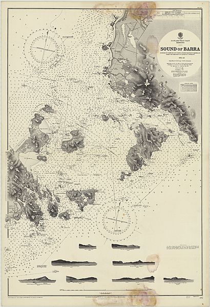
Image: Admiralty Chart No 2770 Sound of Barra, 1945, Originally published 1863

Size of this preview: 410 × 599 pixels. Other resolutions: 164 × 240 pixels | 11,160 × 16,299 pixels.
Original image (11,160 × 16,299 pixels, file size: 26.62 MB, MIME type: image/jpeg)
Description: Hydrographic Office map of the Sound of Barra to Loch Boisdale, 1945, Surveyed by Commr. Aird, Lieut. Hawes, G. Stanley Master, W.F. Maxwell under the direction of Capt. H.C. Otter 1861-2
Title: Admiralty Chart No 2770 Sound of Barra, 1945, Originally published 1863
Credit: National Library of Scotland
Author: Hydrographic Office of the Admiralty
Usage Terms: Public domain
License: Public domain
Attribution Required?: No
Image usage
The following page links to this image:

All content from Kiddle encyclopedia articles (including the article images and facts) can be freely used under Attribution-ShareAlike license, unless stated otherwise.