
Image: Aerial view of Discovery Park and Fort Lawton in Seattle
Size of this preview: 800 × 600 pixels. Other resolutions: 320 × 240 pixels | 3,264 × 2,448 pixels.
Original image (3,264 × 2,448 pixels, file size: 2.67 MB, MIME type: image/jpeg)
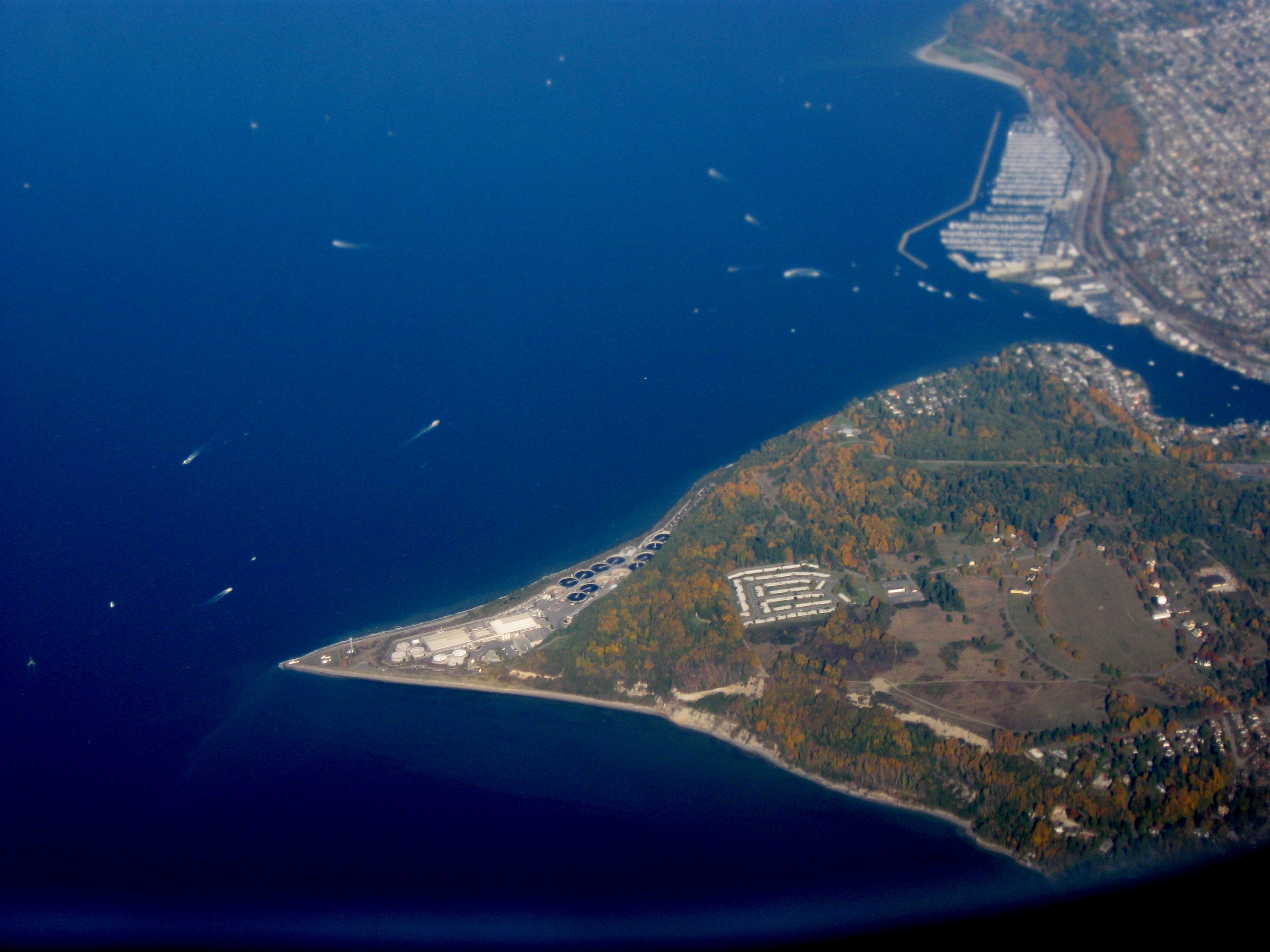
Description: Aerial view of Magnolia peninsular neighborhood in Seattle, facing north north west. Left is Puget Sound, center right is Lake Washington Ship Canal, top right is Ballard. Bottom left (on the pointy bit) is LH and Sewer Plant, forested area is Discovery Park, brown area is Fort Lawton Military Reserve. Taken by myself from a commercial airliner window.
Title: Aerial view of Discovery Park and Fort Lawton in Seattle
Credit: Own work
Author: Dcoetzee
Usage Terms: Public domain
License: Public domain
Attribution Required?: No
Image usage
The following 2 pages link to this image:

All content from Kiddle encyclopedia articles (including the article images and facts) can be freely used under Attribution-ShareAlike license, unless stated otherwise.