
Image: Afghanistan insurgency 1985
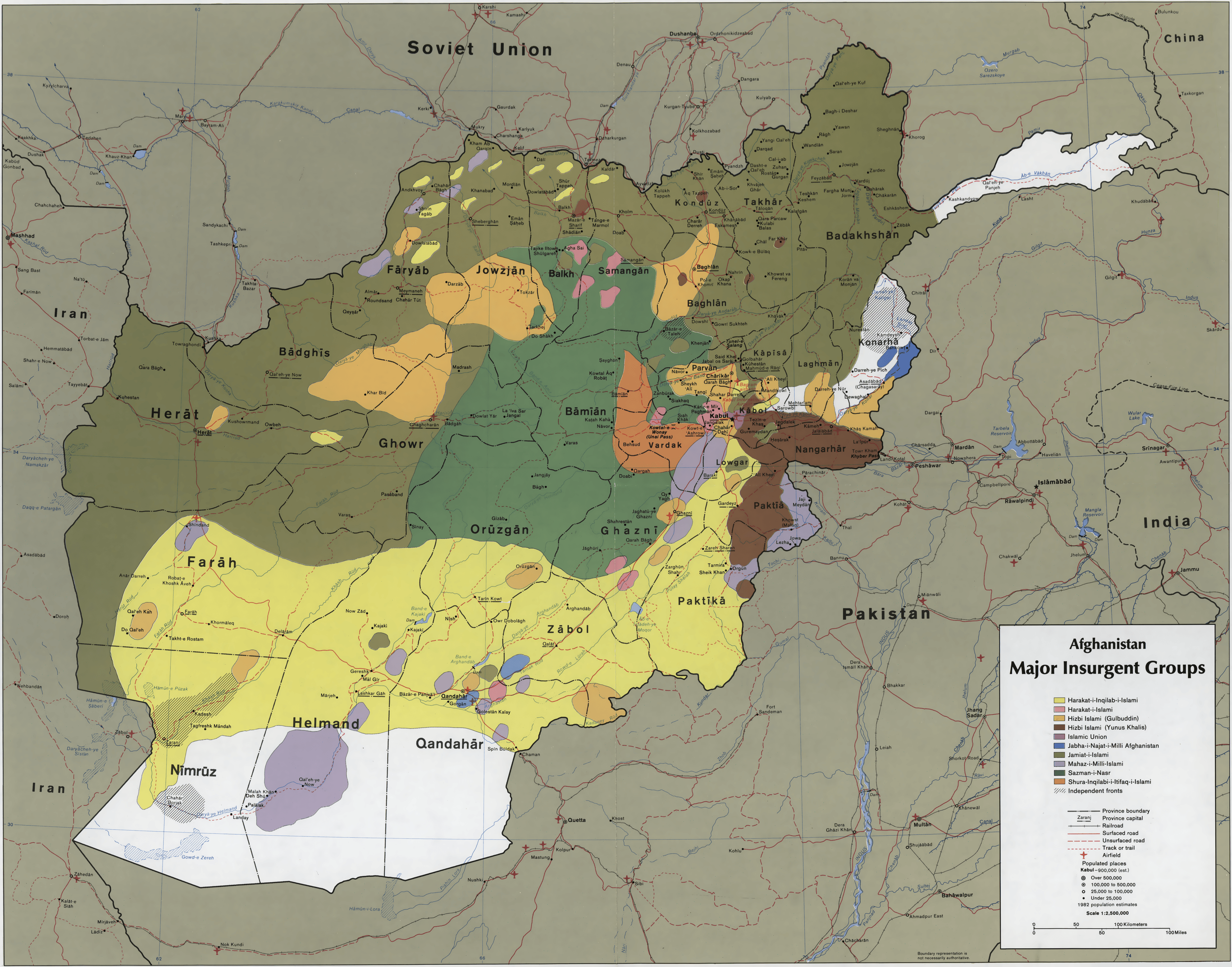
Description: CIA map showing the areas where the main Mujahideen factions operated in 1985, during the Soviet war in Afghanistan. Scale 1:2,500,000 (E 60°–E 75°/N 29°–N 38°).
Title: Afghanistan insurgency 1985
Credit: This map is available from the United States Library of Congress's Geography & Map Division under the digital ID g7631r.ct001104. This tag does not indicate the copyright status of the attached work. A normal copyright tag is still required. See Commons:Licensing for more information. العربية | čeština | Deutsch | English | español | فارسی | suomi | français | magyar | italiano | македонски | മലയാളം | Nederlands | polski | português | русский | slovenčina | slovenščina | Türkçe | українська | 中文 | 中文(简体) | 中文(繁體) | +/−
Author: Central Intelligence Agency
Permission: This image is a work of a Central Intelligence Agency employee, taken or made as part of that person's official duties. As a Work of the United States Government, this image or media is in the public domain in the United States. Български | Čeština | Deutsch | English | Español | Eesti | Suomi | Italiano | 日本語 | 한국어 | Македонски | മലയാളം | Polski | Português | Русский | Sicilianu | Slovenščina | Українська | 中文 | 中文(简体) | +/−
Usage Terms: Public domain
License: Public domain
Attribution Required?: No
Image usage
The following page links to this image:
