
Image: Aksai Chin Sino-Indian border map
Size of this preview: 429 × 600 pixels. Other resolutions: 172 × 240 pixels | 624 × 872 pixels.
Original image (624 × 872 pixels, file size: 102 KB, MIME type: image/png)
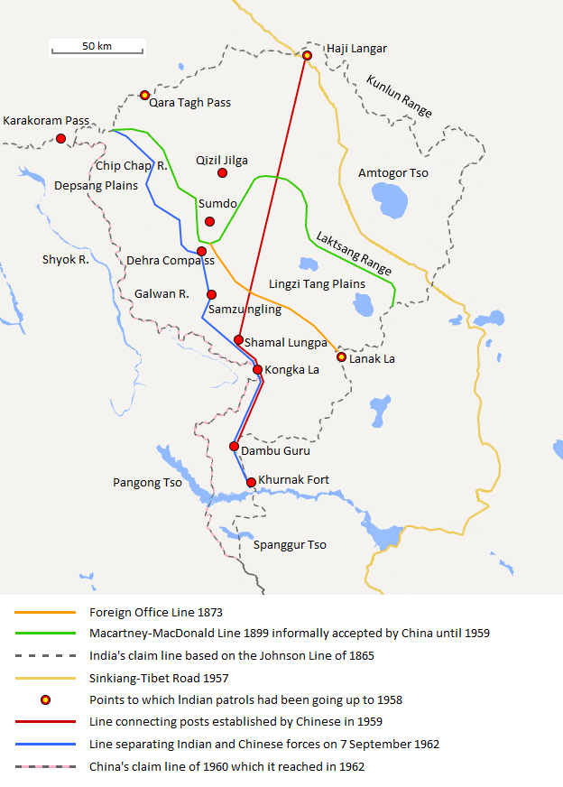
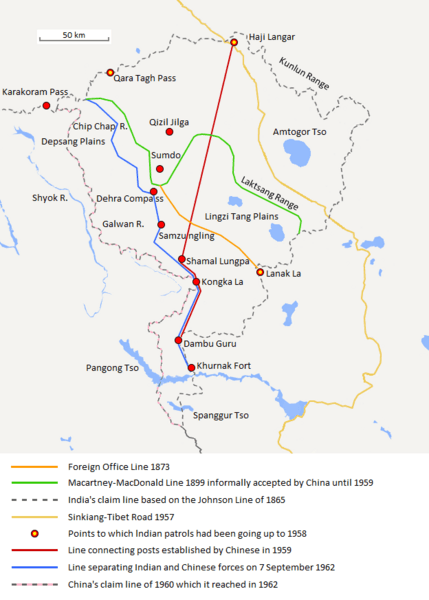
Description: The map shows the Indian and Chinese claims of the border in the Aksai Chin region, the Macartney-MacDonald line, the Foreign Office Line, as well as the progress of Chinese forces as they occupied areas during the Sino-Indian War.
Title: Aksai Chin Sino-Indian border map
Credit: Own work
Author: The Discoverer
Usage Terms: Creative Commons Attribution-Share Alike 3.0
License: CC BY-SA 3.0
License Link: http://creativecommons.org/licenses/by-sa/3.0
Attribution Required?: Yes
Image usage
The following page links to this image:

All content from Kiddle encyclopedia articles (including the article images and facts) can be freely used under Attribution-ShareAlike license, unless stated otherwise.