
Image: AlamoplanF0385
Size of this preview: 487 × 600 pixels. Other resolutions: 195 × 240 pixels | 600 × 739 pixels.
Original image (600 × 739 pixels, file size: 111 KB, MIME type: image/jpeg)
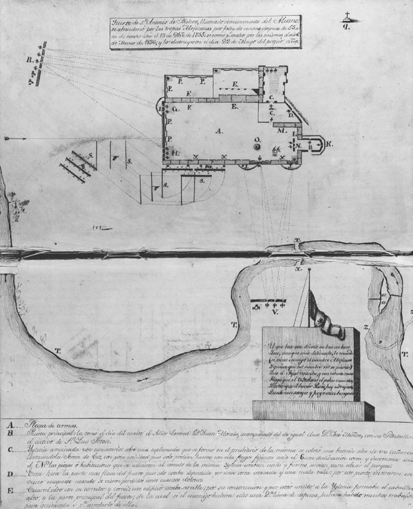
Description: Plan of the Alamo, by José Juan Sánchez-Navarro, 1836. This manuscript map, part of an official military report on the fall of the Alamo, clearly shows where the Mexicans had positioned their cannons (at R and V) and the line of attack of troops under General Cos (S).
Title: AlamoplanF0385
Credit: José Sánchez-Navarro Papers, The Center for American History, The University of Texas at Austin; CN 01579a.
Author: José Juan Sánchez-Navarro
Usage Terms: Public domain
License: Public domain
Attribution Required?: No
Image usage
The following 2 pages link to this image:

All content from Kiddle encyclopedia articles (including the article images and facts) can be freely used under Attribution-ShareAlike license, unless stated otherwise.