
Image: Alaska sept 20 2010
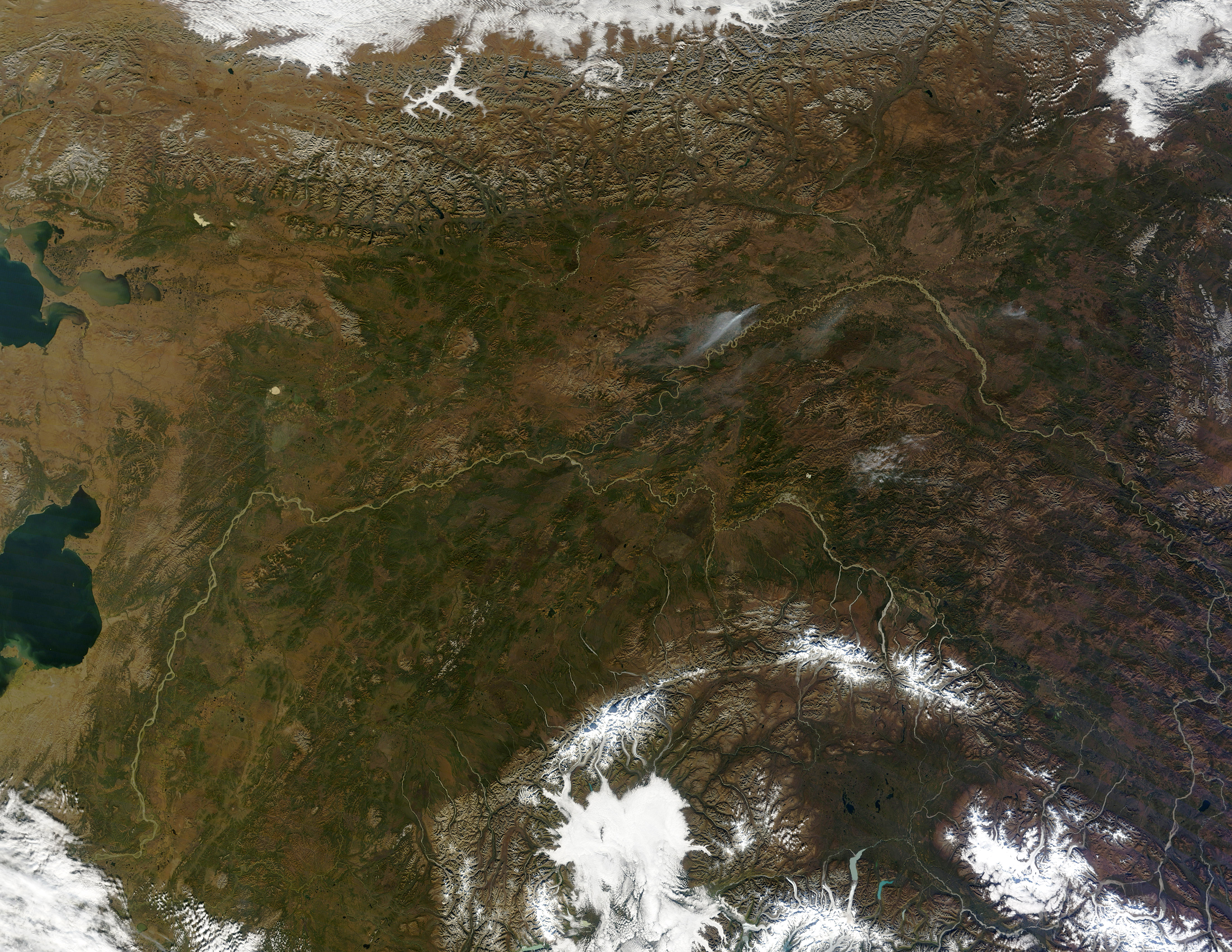
Description: Rivers of water and ice flow across the landscape north of Anchorage, Alaska, where summer is fleeting and fall arrives early. The Moderate Resolution Imaging Spectroradiometer (MODIS) on NASA’s Terra satellite captured this mostly cloudless, natural-color image view of the region on September 20, 2010. Snowy peaks of the Alaska Range—Mount McKinley, among them—form an arc through the middle of the image. Though not as tall as Mount Everest when measured from sea level, McKinley has the greatest elevation between its base and summit, and it is the tallest mountain in North America. To the south lie the Wrangell Mountains, including Mount Blackburn, and the Chugach Mountains, including Mount Witherspoon. All of the ranges are topped with networks of glaciers, some of them terminating in lakes. Glacial flour—fine particles of rock ground off nearby slopes—lends the lakes a blue-green color. West of Witherspoon and south of McKinley, a cloud bank pushes northward, nearly indistinguishable from the snow. The low-lying clouds fill valleys, roughly mimicking the shapes and colors of glaciers. Much of the region lies within Denali National Park. To the north lies the Yukon Flats National Wildlife Refuge, where a fire broke out days before MODIS acquired this image. Although fall had not officially begun in the lower 48 United States, the season was well underway in Alaska by September 20, 2010, when rusts and browns predominated. Summer is short in Denali—just June and July—and autumn generally begins in August. Winter usually lasts from October through April. Central Alaska seen from the space NASA description: Terra/MODIS 2010/263 21:40 UTC Central Alaska projection: Plate Carree projection center lon: -151.0000 projection center lat: +65.0000 image center lon: -151 image center lat: +65 standard parallel: +65.0000 UL lon: -162.7012 UL lat: +68.8216 UR lon: -139.2935 UR lat: +68.8216 LR lon: -139.2935 LR lat: +61.1774 LL lon: -162.7012 LL lat: +61.1774 UL easting (km): -549.8750 UL northing (km): +7652.6250 x scale factor: +0.4226182617406994 ellipsoid: WGS84 Contact: Jeff Schmaltz 5 minute swath data used for this image: 21:40 UTC
Title: Alaska sept 20 2010
Credit: http://earthobservatory.nasa.gov/IOTD/view.php?id=46142
Author: NASA image by Jeff Schmaltz, MODIS Rapid Response Team at NASA GSFC. Caption by Michon Scott.
Usage Terms: Public domain
License: Public domain
Attribution Required?: No
Image usage
The following page links to this image:
