
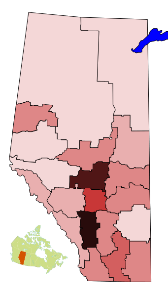
Image: Alberta Census divisions - population density

Size of this PNG preview of this SVG file: 341 × 599 pixels. Other resolution: 136 × 240 pixels.
Original image (SVG file, nominally 352 × 618 pixels, file size: 119 KB)
Description: Map of census divisions of Alberta by population density according to the 2006 census. Legend (people/square km): 0-1 1.1-2 2.1-5 5.1-10 10.1-20 20.1-40 40.1-60 60.1-80 >80 This vector image was created with Inkscape.
Title: Alberta Census divisions - population density
Credit: Own work
Author: TastyCakes on English Wikipedia
Usage Terms: Creative Commons Attribution 3.0
License: CC BY 3.0
License Link: http://creativecommons.org/licenses/by/3.0
Attribution Required?: Yes
Image usage
The following page links to this image:

All content from Kiddle encyclopedia articles (including the article images and facts) can be freely used under Attribution-ShareAlike license, unless stated otherwise.