
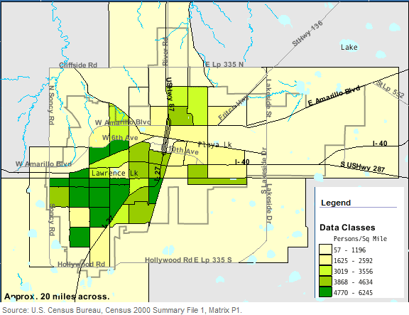
Image: Amarillo Texas - Persons Per Square Mils - Census 2000
No higher resolution available.
Amarillo_Texas_-_Persons_Per_Square_Mils_-_Census_2000.png (576 × 443 pixels, file size: 26 KB, MIME type: image/png)
Description: This map shows the city of Amarillo, USA by average number of inhabitants per square mile of land in 2000. Edited by the uploader to make it into a single image.
Title: Amarillo Texas - Persons Per Square Mils - Census 2000
Credit: factfinder.census.gov
Usage Terms: Public domain
License: Public domain
Attribution Required?: No
Image usage
The following page links to this image:

All content from Kiddle encyclopedia articles (including the article images and facts) can be freely used under Attribution-ShareAlike license, unless stated otherwise.