
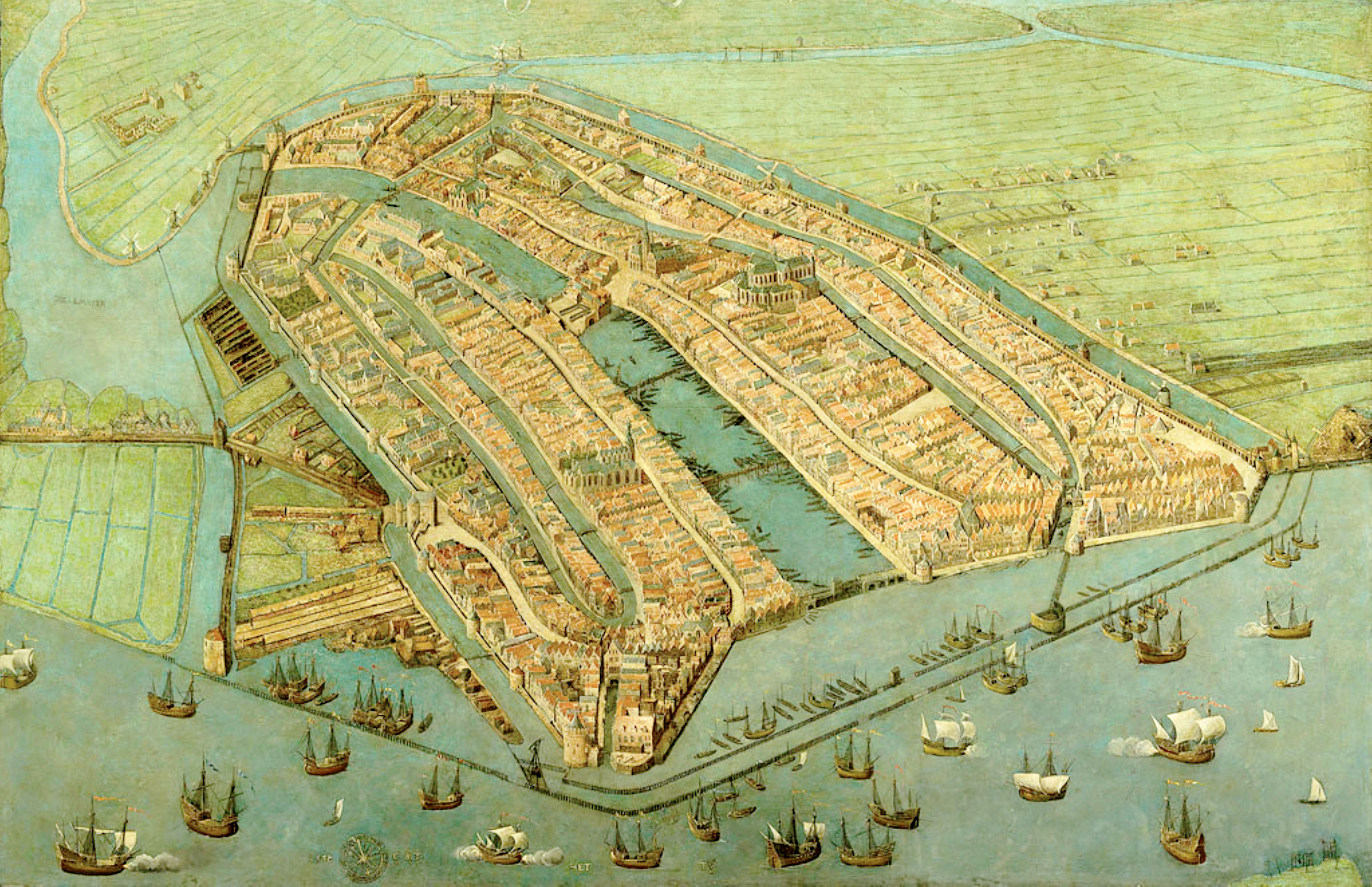
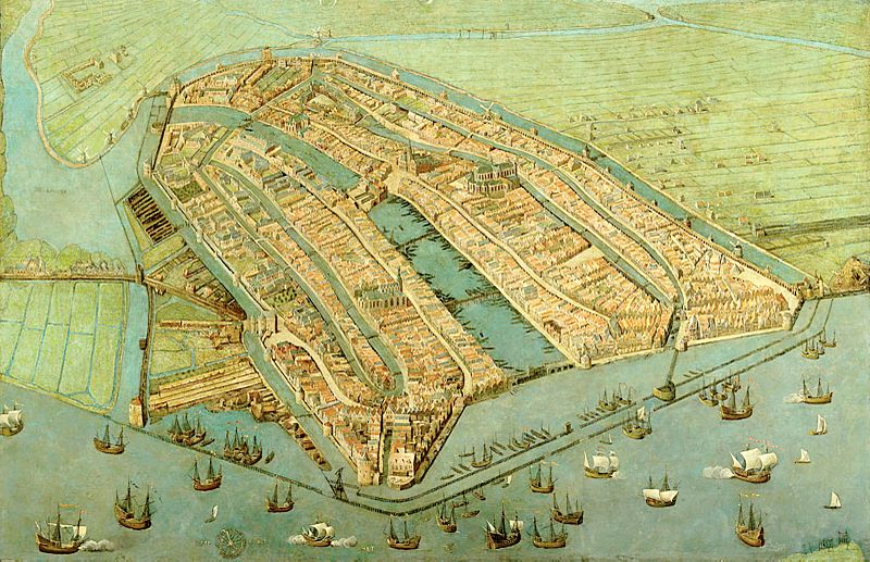
Image: Amsterdam in 1538
Size of this preview: 800 × 517 pixels. Other resolutions: 320 × 207 pixels | 6,400 × 4,138 pixels.
Original image (6,400 × 4,138 pixels, file size: 2.92 MB, MIME type: image/jpeg)
Description: Oldest surviving map of Amsterdam, showing the city's finished medieval walls, towers and gates. Like in most old maps of Amsterdam the city is shown from the IJ, so that the view is directed to the south rather than the north.
Usage Terms: Public domain
Image usage
The following page links to this image:

All content from Kiddle encyclopedia articles (including the article images and facts) can be freely used under Attribution-ShareAlike license, unless stated otherwise.