
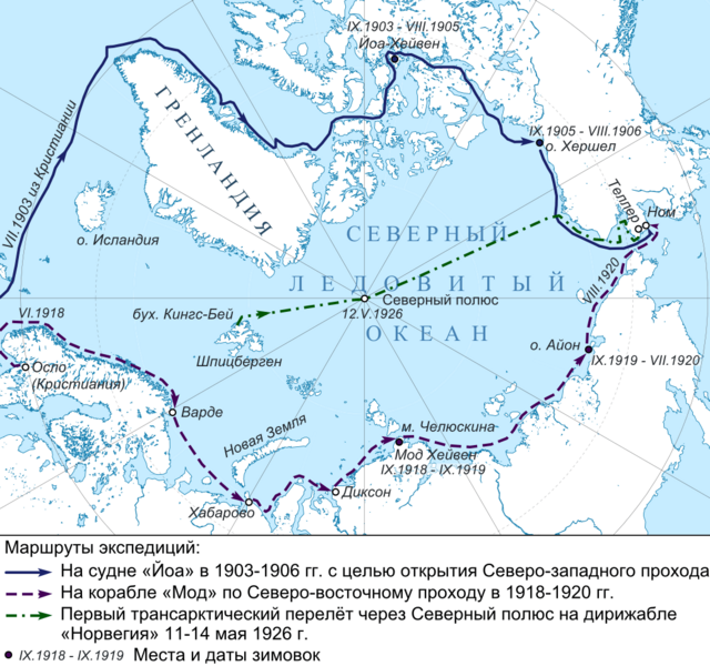
Image: Amundsen Map 1 ru

Size of this preview: 640 × 600 pixels. Other resolutions: 256 × 240 pixels | 1,055 × 989 pixels.
Original image (1,055 × 989 pixels, file size: 622 KB, MIME type: image/png)
Description: Карта арктических экспедиций Амундсена. Инструменты: GMT, Inkscape
Title: Amundsen Map 1 ru
Credit: GSHHS dataset for coastline Own work This vector image was created with Inkscape.
Author: Nzeemin
Usage Terms: Creative Commons Attribution-Share Alike 3.0
License: CC BY-SA 3.0
License Link: http://creativecommons.org/licenses/by-sa/3.0
Attribution Required?: Yes
Image usage
There are no pages that link to this image.

All content from Kiddle encyclopedia articles (including the article images and facts) can be freely used under Attribution-ShareAlike license, unless stated otherwise.