
Image: Anatolian Plate

Size of this preview: 800 × 502 pixels. Other resolutions: 320 × 201 pixels | 2,477 × 1,554 pixels.
Original image (2,477 × 1,554 pixels, file size: 2.11 MB, MIME type: image/png)
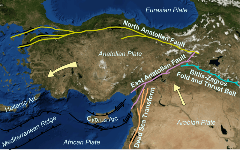
Description: Map showing main tectonic structures around the Anatolian Plate on a base taken from a snapshot from Nasa's World Wind software. Arrows show displacement vectors of the Anatolian and Arabian Plates relative to the Eurasian Plate. The locations of the various structures were taken from many published maps.
Title: Anatolian Plate
Credit: Own work
Author: Mikenorton
Usage Terms: Creative Commons Attribution-Share Alike 3.0
License: CC BY-SA 3.0
License Link: https://creativecommons.org/licenses/by-sa/3.0
Attribution Required?: Yes
Image usage
The following page links to this image:

All content from Kiddle encyclopedia articles (including the article images and facts) can be freely used under Attribution-ShareAlike license, unless stated otherwise.