
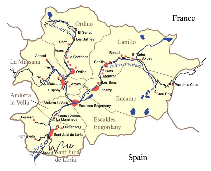
Image: Andorramap
Size of this preview: 738 × 600 pixels. Other resolutions: 295 × 240 pixels | 800 × 650 pixels.
Original image (800 × 650 pixels, file size: 115 KB, MIME type: image/png)
Description: General map of Andorra. I, Karl Musser, created it based on a map on the Andorra government web page.
Title: Andorramap
Credit: No machine-readable source provided. Own work assumed (based on copyright claims).
Author: No machine-readable author provided. Kmusser assumed (based on copyright claims).
Usage Terms: Creative Commons Attribution-Share Alike 2.5
License: CC BY-SA 2.5
License Link: http://creativecommons.org/licenses/by-sa/2.5
Attribution Required?: Yes
Image usage
The following page links to this image:

All content from Kiddle encyclopedia articles (including the article images and facts) can be freely used under Attribution-ShareAlike license, unless stated otherwise.