
Image: Antarctica (2), Adelaide Island, Mackay Point
Size of this preview: 800 × 531 pixels. Other resolutions: 320 × 213 pixels | 1,716 × 1,140 pixels.
Original image (1,716 × 1,140 pixels, file size: 698 KB, MIME type: image/jpeg)
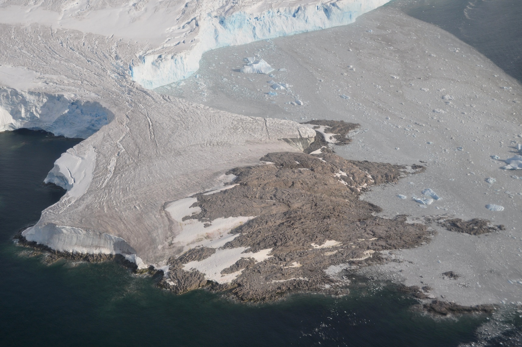
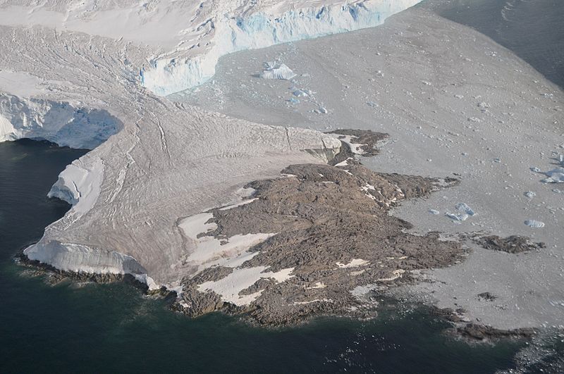
Description: Mackay Point is a tiny peninsula (450 m at its widest point) protruding into Laubeuf Fjord from the Wormald Ice Piedmont on the eastern side of Adelaide Island, Antarctica. It lies 4 km NNE of the British Rothera Research Station.
Title: Antarctica (2), Adelaide Island, Mackay Point
Credit: Own work
Author: Vincent van Zeijst
Usage Terms: Creative Commons Attribution-Share Alike 3.0
License: CC BY-SA 3.0
License Link: https://creativecommons.org/licenses/by-sa/3.0
Attribution Required?: Yes
Image usage
The following page links to this image:

All content from Kiddle encyclopedia articles (including the article images and facts) can be freely used under Attribution-ShareAlike license, unless stated otherwise.
,_Adelaide_Island,_Mackay_Point.JPG)