
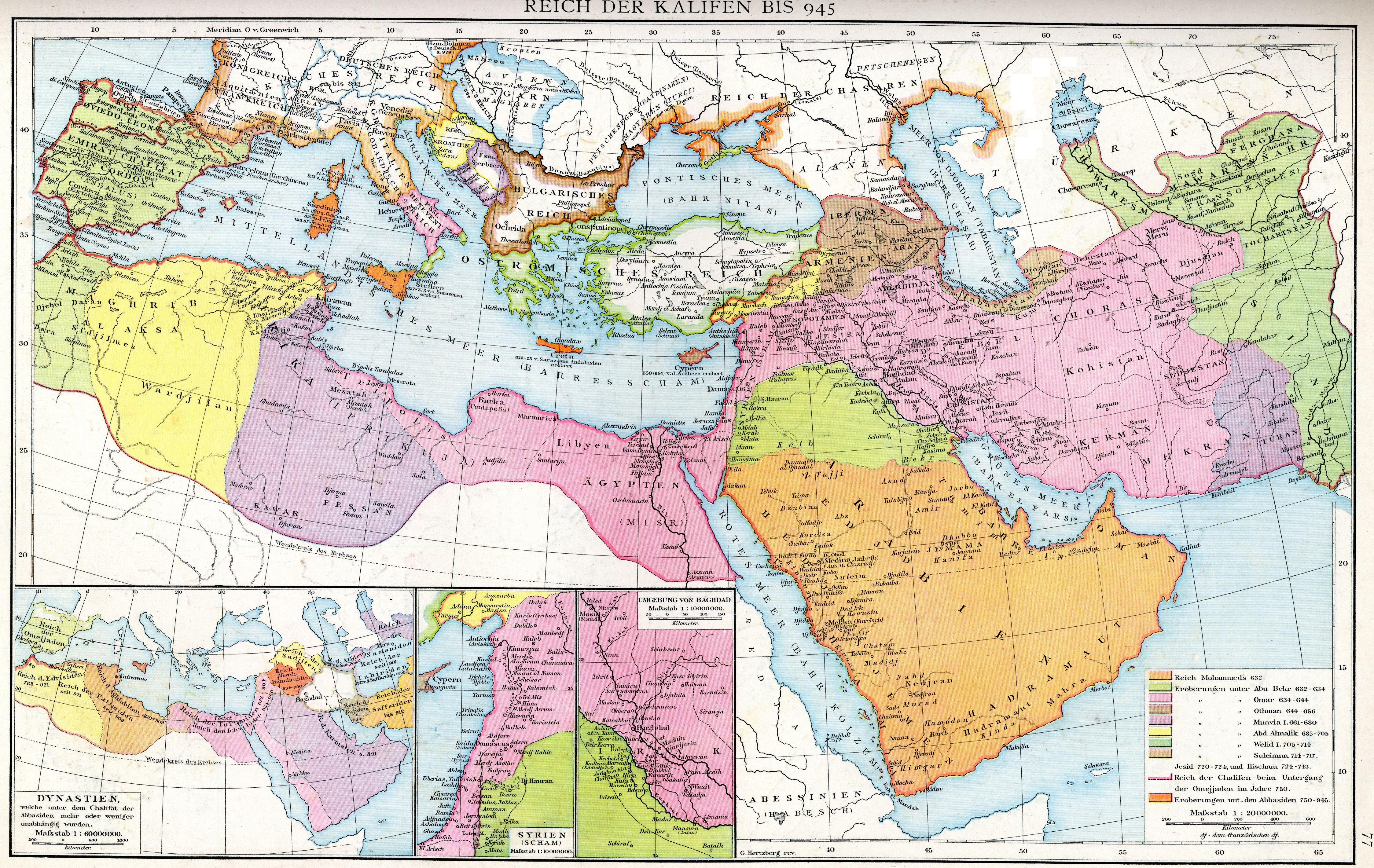
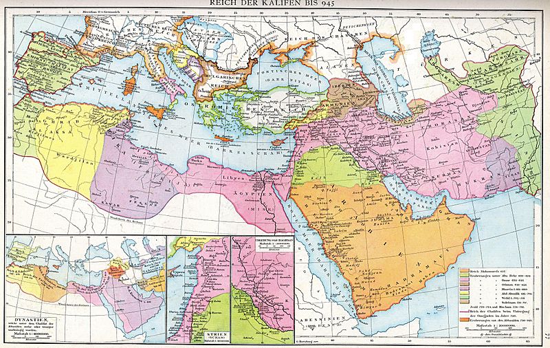
Image: Arabische Eroberung 2
Size of this preview: 800 × 506 pixels. Other resolutions: 320 × 202 pixels | 4,496 × 2,841 pixels.
Original image (4,496 × 2,841 pixels, file size: 3.36 MB, MIME type: image/jpeg)
Description: The empire of the Caliphs to 945. Map of the Historical Atlas of Gustav Droysen, 1886
Title: Arabische Eroberung 2
Credit: Gustav Droysens Allgemeiner historischer Handatlas in 96 Karten mit erläuterndem Text Bielefeld [u.a.]: Velhagen & Klasing 1886, S. 77.
Author: Johann Gustav Droysen (6 July 1808 – 19 June 1884)
Usage Terms: Public domain
License: Public domain
Attribution Required?: No
Image usage
The following 3 pages link to this image:

All content from Kiddle encyclopedia articles (including the article images and facts) can be freely used under Attribution-ShareAlike license, unless stated otherwise.