
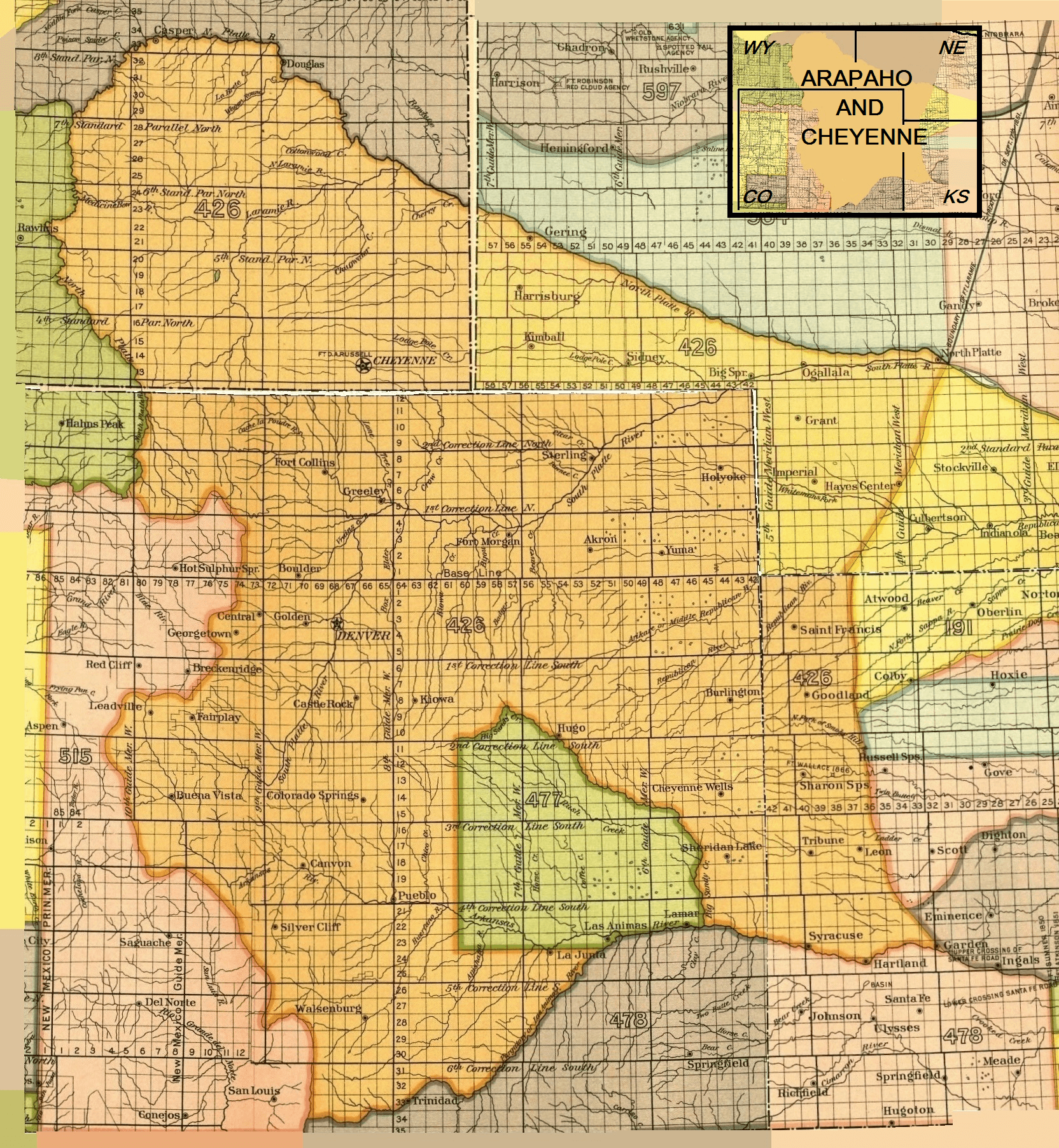
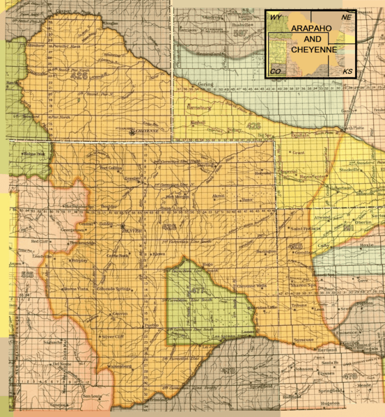
Image: Arapaho and Cheyenne 1851 treaty territory. (Area 426 and 477)
Size of this preview: 553 × 599 pixels. Other resolutions: 221 × 240 pixels | 1,664 × 1,803 pixels.
Original image (1,664 × 1,803 pixels, file size: 6.07 MB, MIME type: image/png)
Description: Map of the Arapaho and Cheyenne Indian territory as described in the Treaty of Fort Laramie (1851), Colorado
Title: Arapaho and Cheyenne 1851 treaty territory. (Area 426 and 477)
Credit: Eighteenth Annual Report of the Bureau of American Ethnology, part 2, 1896-'97
Author: Government Printing Office, 1899
Usage Terms: Public domain
License: Public domain
Attribution Required?: No
Image usage
The following 4 pages link to this image:

All content from Kiddle encyclopedia articles (including the article images and facts) can be freely used under Attribution-ShareAlike license, unless stated otherwise.
.png)