
Image: Argyll and Bute UK location map

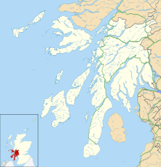
Description: Blank map of Argyll and Bute, UK with the following information shown: Administrative borders Coastline, lakes and rivers Roads and railways Urban areas Equirectangular map projection on WGS 84 datum, with N/S stretched 175% Geographic limits: West: 7.2W East: 4.5W North: 56.8N South: 55.2N
Title: Argyll and Bute UK location map
Credit: Ordnance Survey OpenData. Administrative borders and coastline data from Boundary-Line product. All other geographic data from Meridian 2 product. Inset derived from Inset derived from File:Scotland location map.svg by NordNordWest.
Author: Nilfanion, created using Ordnance Survey data
Permission: This file is licensed under the Creative Commons Attribution-Share Alike 3.0 Unported license. Attribution: Contains Ordnance Survey data © Crown copyright and database right You are free: to share – to copy, distribute and transmit the work to remix – to adapt the work Under the following conditions: attribution – You must give appropriate credit, provide a link to the license, and indicate if changes were made. You may do so in any reasonable manner, but not in any way that suggests the licensor endorses you or your use. share alike – If you remix, transform, or build upon the material, you must distribute your contributions under the same or compatible license as the original. https://creativecommons.org/licenses/by-sa/3.0 CC BY-SA 3.0 Creative Commons Attribution-Share Alike 3.0 truetrue
Usage Terms: Creative Commons Attribution-Share Alike 3.0
License: CC BY-SA 3.0
License Link: https://creativecommons.org/licenses/by-sa/3.0
Attribution Required?: Yes
Image usage
The following 77 pages link to this image:
- Ardalanish
- Ardbeg, Islay
- Ardlussa
- Ardminish
- Ardtalla
- Ardtun
- Arinagour
- Ascog
- Auchenbreck Castle
- Auchindrain
- Ballygrant
- Balvicar
- Bowmore
- Bridgend, Islay
- Bunessan
- Calgary, Mull
- Campbeltown Airport
- Castle MacEwen
- Craighouse
- Craignure
- Dervaig
- Dun Mor Vaul
- Ellenabeich
- Fearnoch
- Feolin
- Fionnphort
- Furnace, Argyll
- Glasdrum Wood
- Glen Nant
- Glen Orchy
- Glenbarr
- HMNB Clyde
- HMS Dartmouth (1655)
- Highland Mary (statue)
- Inverlussa
- Keils
- Kilchattan Bay
- Kilchurn Castle
- Kingarth
- Kintra
- Kinuachdrachd
- Knockan
- Kyles of Bute
- Lagavulin
- Lagg, Jura
- Loch Creran
- Loch Sween
- Lochbuie, Mull
- Mannal
- Moine Mhòr
- Mull of Kintyre
- Nerabus
- Oban
- Old Castle Lachlan
- Pennyghael
- Port Askaig
- Port Bannatyne
- Port Charlotte, Islay
- Port Ellen
- Portnahaven
- RAF Machrihanish
- Saddell
- Salen, Mull
- Scalasaig
- Scarinish
- Shandon, Argyll
- Small Isles, Argyll
- Smerby Castle
- St Conan's Kirk
- Tarbert, Jura
- Tarbert Castle
- Taynish National Nature Reserve
- Tirefour Castle
- Tiroran
- Tobermory, Mull
- Uisken
- Ulva Ferry
