
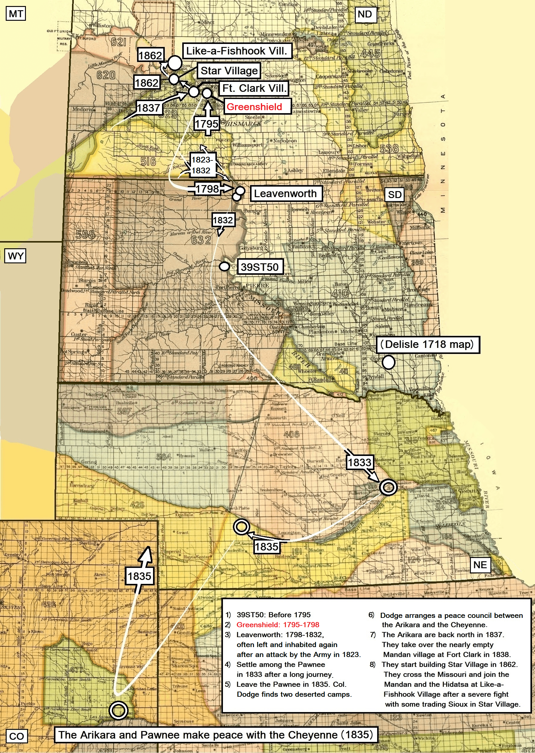
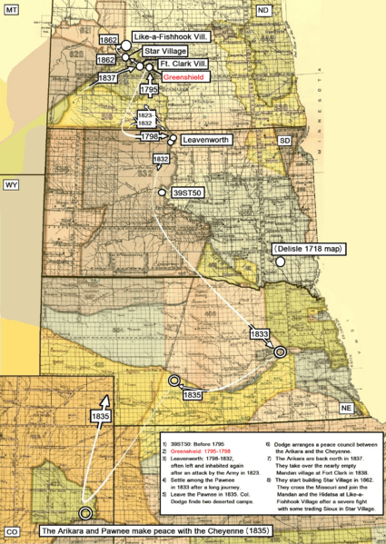
Image: Arikara movements, 1795 to 1862
Description: Map adapted to show the major movements (approximately) of the Arikara tribe from 1795 to 1862. Source to archaelogical site 39ST50 and Greenshild.: Johnson, Craig M. (2007): A Chronology of Middle Missouri Plains Village Sites. Smithsonian contributions to Anthropology • number 47. Washington. P. 199 Sources to Delisle 1718 map, Leavenworth Site, the stay in present Nebraska and the peace council with the Cheyenne: Wood, Raymond W.: Historical and Archeological Evidence for Arikara Visits to the Central Plains. Plains Anthropologist. 1955 (July), No. 4, pp. 27-39. Meyer, Roy W. (1977): The Village Indians of the Upper Missouri. Lincoln and London. Pp. 87-89.
Source to the Mandan village at Fort Clark, Star Village and Like-a-Fishhook Village: Meyer, Roy W. (1977): The Village Indians of the Upper Missouri. Lincoln and London. Pp. 90 and 108
Usage Terms: Public domain
Image usage
The following page links to this image:
