
Image: Arizona ref 2001
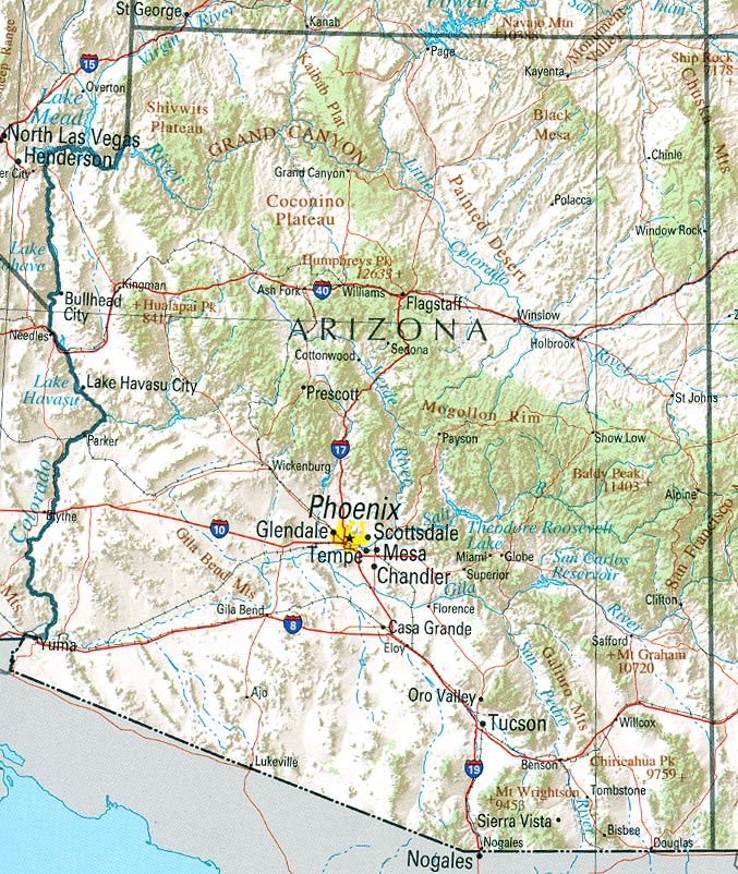
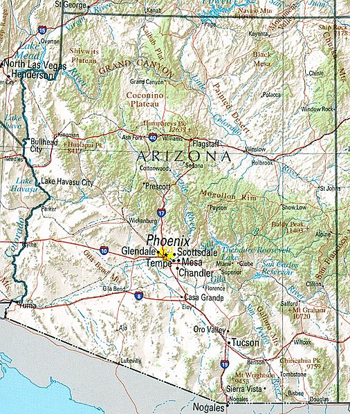
Description: Map of Arizona. Shaded relief map with state boundaries, forest cover, place names, major highways. Portion of "The National Atlas of the United States of America. General Reference", compiled by U.S. Geological Survey 2001, printed 2002
Title: Arizona ref 2001
Credit: Courtesy of the University of Texas Libraries, The University of Texas at Austin
Author: U.S. Geological Survey 2001
Permission: This image is in the public domain in the United States because it only contains materials that originally came from the United States Geological Survey, an agency of the United States Department of the Interior. For more information, see the official USGS copyright policy. Български | Català | Čeština | Deutsch | English | Español | Eesti | فارسی | Suomi | Français | Galego | Italiano | 日本語 | 한국어 | Македонски | മലയാളം | Nederlands | Polski | Português | Русский | Sicilianu | Türkçe | 中文 | 中文(简体) | +/−
Usage Terms: Public domain
License: Public domain
Attribution Required?: No
Image usage
The following page links to this image:
