
Image: ArlingtonTODimage3
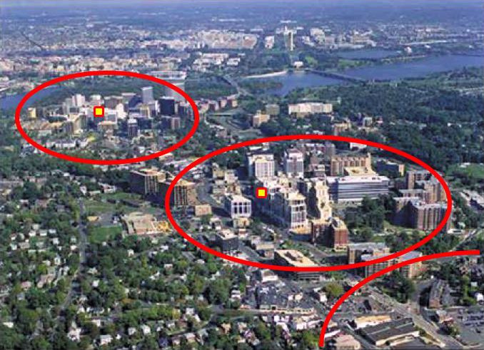
Description: Aerial view of growth patterns in Arlington County. High density, mixed use development is concentrated within ¼–½ mile from the Rosslyn, Court House and Clarendon Metro stations (shown in red), with limited density outside that area. This photograph is taken from the United States Environmental Protection Agency [1] website describing Arlington's award for overall excellence in smart growth in 2002 — the first ever granted by the agency.
Title: ArlingtonTODimage3
Credit: Derivative of :Image:ArlingtonRb aerial.jpg
Author: This image was altered by Thesmothete with additional graphical elements to indicate the location of transit stations and the extent of development around them.
Usage Terms: Public domain
License: Public domain
Attribution Required?: No
Image usage
The following page links to this image:
