
Image: Armero aftermath Marso
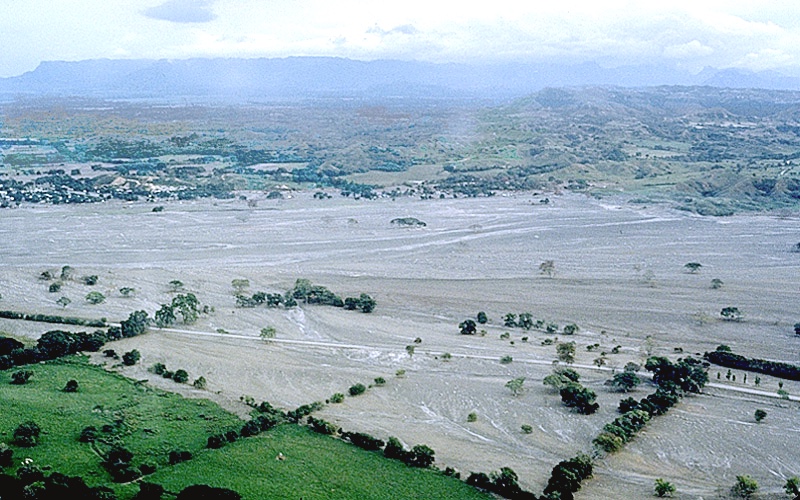
Description: Río Lagunillas, former location of Armero. An explosive eruption from Ruiz's summit crater on November 13, 1985, at 9:08 p.m. generated an eruption column and sent a series of pyroclastic flows and surges across the volcano's broad ice-covered summit. Pumice and meltwater produced by the hot pyroclastic flows and surges swept into gullies and channels on the slopes of Ruiz as a series of small lahars. Flowing downstream from Ruiz at an average speed of 60 km per hour, lahars eroded soil, loose rock debris and stripped vegetation from river channels. By incorporating water and debris from along river channels, the lahars grew in size as they moved away from the volcano--some lahars increased up to 4 times their initial volumes. Within four hours of the beginning of the eruption, lahars had traveled 100 km and left behind a wake of destruction: more than 23,000 people killed, about 5,000 injured, and more than 5,000 homes destroyed along the Chinchiná, Gualí, and Lagunillas rivers. Hardest hit was the town of Armero at the mouth of the Río Lagunillas canyon, which was located in the center of this photograph. Three quarters of its 28,700 inhabitants perished. (Amalgamation of sentences taken verbatim from source.)
Title: Armero aftermath Marso
Credit: source, small version with description here
Author: Jeffrey Marso, USGS geologist
Usage Terms: Public domain
License: Public domain
Attribution Required?: No
Image usage
The following 4 pages link to this image:
