
Image: Arthur St. Clair court-martial map
Size of this preview: 354 × 600 pixels. Other resolutions: 141 × 240 pixels | 500 × 847 pixels.
Original image (500 × 847 pixels, file size: 315 KB, MIME type: image/jpeg)
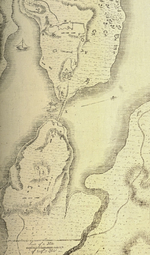
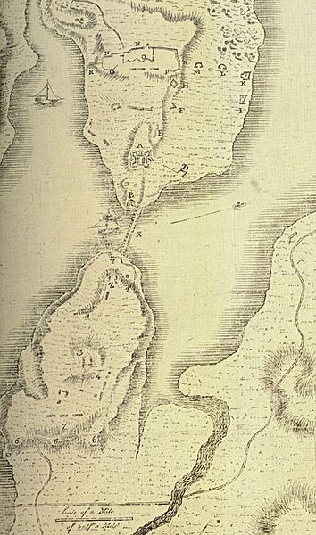
Description: The map of the Lake Champlain forts used at the court-martial of General Arthur St. Clair following his decision to abandon Ticonderoga and Mount Independence.
Title: Arthur St. Clair court-martial map
Credit: Proceedings of a general court martial, held at White Plains in the state of New-York, by order of His Excellency General Washington for the trial of Major General St. Clair, August 25, 1778
Author: U.S. government, U.S. (Continental) army
Usage Terms: Public domain
License: Public domain
Attribution Required?: No
Image usage
The following page links to this image:

All content from Kiddle encyclopedia articles (including the article images and facts) can be freely used under Attribution-ShareAlike license, unless stated otherwise.