
Image: Assateague Island aerial view

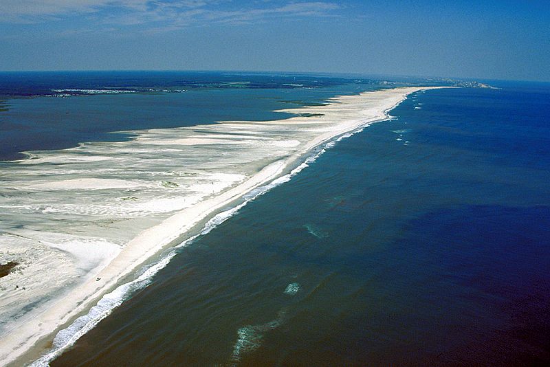
Description: Aerial view of Assateague Island on the Atlantic Ocean in Maryland, USA. The photograph shows the erosion to the beaches due to Atlantic storms. In the far distance at the top right is Ocean City, Maryland.
Title: Assateague Island aerial view
Credit: U.S. Army Corps of Engineers Digital Visual Library Image page Image description page Digital Visual Library home page
Author: Susanne Bledsoe, U.S. Army Corps of Engineers
Permission: This image or file is a work of a U.S. Army Corps of Engineers soldier or employee, taken or made as part of that person's official duties. As a work of the U.S. federal government, the image is in the public domain. English | italiano | Nederlands | русский | Türkçe | українська | +/−
Usage Terms: Public domain
License: Public domain
Attribution Required?: No
Image usage
The following page links to this image:
