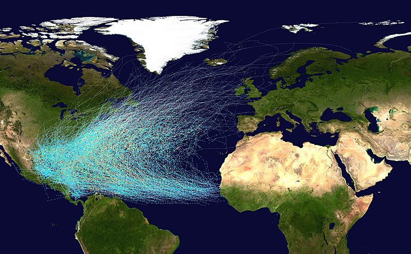
Image: Atlantic hurricane tracks

Description: This map shows the tracks of all Atlantic hurricanes which formed between 1851 and 2012. The points show the locations of the storms at six-hourly intervals and use the color scheme shown to the right from Saffir-Simpson Hurricane Scale.
Title: Atlantic hurricane tracks
Credit: Created using User:jdorje/Tracks by Nilfanion on 2006-08-05. Background image from File:Whole world - land and oceans.jpg (NASA). Tracking data for storms is from the National Hurricane Center.[1]
Author: Nilfanion
Permission: I, the copyright holder of this work, release this work into the public domain. This applies worldwide. In some countries this may not be legally possible; if so: I grant anyone the right to use this work for any purpose, without any conditions, unless such conditions are required by law.
Usage Terms: Public domain
License: Public domain
Attribution Required?: No
Image usage
The following 3 pages link to this image:

