
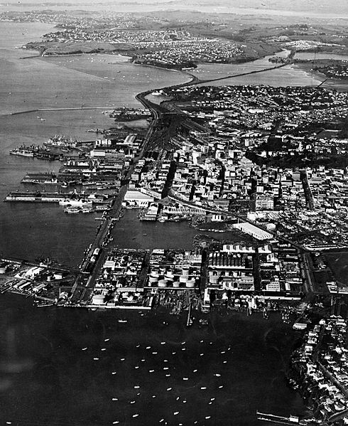
Image: Auckland CBD And Waterfront In The 1950s

Description: Looking east over what will one day become Wynyard Quarter in the foreground, then the Auckland CBD in the middle distance, and Hobson Bay in the distance. New Zealand in the 1950s. Coordinates approximate, but reasonably exact in the north-south axis, and likely somewhere above Point Erin. Extended information on origin webpage reads: Aerial view of Auckland City's waterfront circa 1950s. Looks east towards Mechanics Bay with the Westhaven Boat Harbour in the foreground. Taken by an unidentified photographer.
Title: Auckland CBD And Waterfront In The 1950s
Credit: National Library of New Zealand (Alexander Turnbull Library).
Author: The National Library of New Zealand (Alexander Turnbull Library) states specifically that the author is unknown. See relevance of this below.
Permission: See below. It should be noted that NZ copyright provides a term of 50 years after the author's death/publication by a corporation, and provides for a term of only 50 years after publication if the author is unknown. Therefore, based on the unknown identity of the author and the publication date, this document is in the public domain.
Usage Terms: Public domain
License: Public domain
Attribution Required?: No
Image usage
The following page links to this image:
