
Image: Australia South Australia relief location map

Size of this preview: 516 × 599 pixels. Other resolutions: 207 × 240 pixels | 1,812 × 2,105 pixels.
Original image (1,812 × 2,105 pixels, file size: 719 KB, MIME type: image/png)
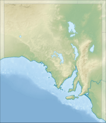
Description: Location map of South Australia, Australia Equidistant cylindrical projection, latitude of true scale 31.27° S (equivalent to equirectangular projection with N/S stretching 117 %). Geographic limits of the map: N: 25.6° S S: 38.5° S W: 128.5° E E: 141.5° E
Title: Australia South Australia relief location map
Credit: DEM: CleanTOPO 2 Shaded relief, coastline, boundaries, rivers and lakes: Natural Earth
Author: Tentotwo
Usage Terms: Creative Commons Attribution-Share Alike 3.0
License: CC BY-SA 3.0
License Link: https://creativecommons.org/licenses/by-sa/3.0
Attribution Required?: Yes
Image usage
More than 100 pages link to this image. The following list shows the first 100 page links to this image only. A full list is available.
- Adelaide Dolphin Sanctuary
- Adelaide International Bird Sanctuary National Park—Winaityinaityi Pangkara
- Alberga River
- Aldinga Bay
- Aldinga Reef Aquatic Reserve
- Allendale East
- American River Aquatic Reserve
- Andamooka, South Australia
- Anxious Bay
- Arno Bay, South Australia
- Aroona Dam
- Bakara Conservation Park
- Bales Beach Aquatic Reserve
- Bangham Conservation Park
- Barker Inlet
- Barker Inlet – St Kilda Aquatic Reserve
- Baroota Reservoir
- Barossa Reservoir
- Barwell Conservation Park
- Bascombe Well Conservation Park
- Beatrice Islet Conservation Park
- Belair National Park
- Beyeria Conservation Park
- Big Heath Conservation Park
- Billiatt Conservation Park
- Bird Islands Conservation Park
- Black Hill Conservation Park
- Bon Bon Reserve
- Bool Lagoon Game Reserve
- Boolcoomatta Reserve
- Boondina Conservation Park
- Brompton, South Australia
- Brown Hill Creek
- Buckaringa Sanctuary
- Butchers Gap Conservation Park
- Calpatanna Waterhole Conservation Park
- Calperum Station (reserve)
- Cape Banks Lighthouse
- Cape Torrens Wilderness Protection Area
- Caralue Bluff Conservation Park
- Carappee Hill Conservation Park
- Chowilla Regional Reserve
- Clare Valley
- Cleland Conservation Park
- Clements Gap Conservation Park
- Cobbler Creek Recreation Park
- Cocata Conservation Park
- Coobowie Aquatic Reserve
- Coongie Lakes
- Coorong National Park
- Corrobinnie Hill Conservation Park
- Cox Scrub Conservation Park
- Currency Creek Game Reserve
- D'Estrees Bay
- Darke Range Conservation Park
- Deep Creek Conservation Park
- Desert Camp Conservation Park
- Desert Camp Conservation Reserve
- Dhilba Guuranda-Innes National Park
- Dingley Dell Conservation Park
- Dutton, South Australia
- Ediacara Conservation Park
- Ewens Ponds
- Eyre Creek (South Australia)
- Fairview Conservation Park
- False Bay, South Australia
- Ferries McDonald Conservation Park
- Field River
- Flinders Chase National Park
- Fort Glanville Conservation Park
- Gum Creek, South Australia
- Hambidge Wilderness Protection Area
- Head of the Bight
- Kaiserstuhl Conservation Park
- Kangaroo Island
- Lake Albert (South Australia)
- Lake Alexandrina (South Australia)
- Lake Dutton
- Lake Frome
- Lake Gairdner
- Lake MacDonnell
- Maralinga
- Mount Hill (South Australia)
- Mount Hopeless (South Australia)
- Mount Lofty
- Mount Woodroffe
- Murray Town, South Australia
- Oak Valley, South Australia
- Panalatinga Creek
- Penong, South Australia
- Perlubie, South Australia
- Pondalowie Bay
- Port Kenny, South Australia
- Strzelecki Regional Reserve
- Stuart Range, South Australia
- Taldra, South Australia
- Ulooloo, South Australia
- Vivonne Bay (South Australia)
- Vulkathunha-Gammon Ranges National Park
- Wakefield River

All content from Kiddle encyclopedia articles (including the article images and facts) can be freely used under Attribution-ShareAlike license, unless stated otherwise.