
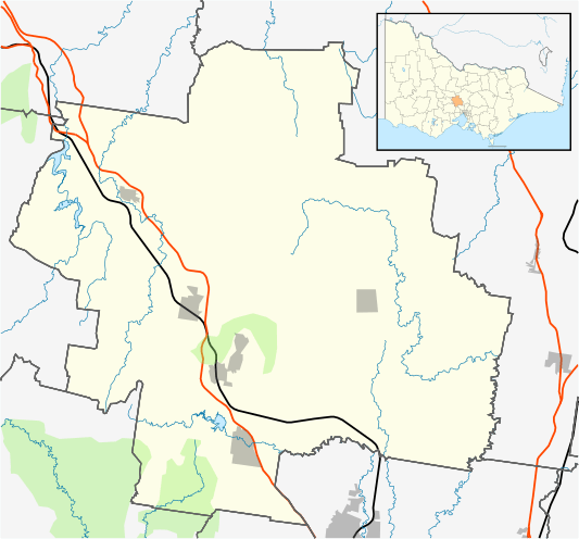
Image: Australia Victoria Macedon Ranges Shire location map

Description: Blank map of w:Macedon Ranges Shire, Victoria, Australia, with the following information shown: LGA boundaries Coastline, lakes and rivers Roads and railways Urban areas Parks Geographic limits: North: 37.06S East: 145.0E South: 37.58S West: 144.3E Permission is granted to copy, distribute and/or modify this document under the terms of the GNU Free Documentation License, Version 1.2 or any later version published by the Free Software Foundation; with no Invariant Sections, no Front-Cover Texts, and no Back-Cover Texts. A copy of the license is included in the section entitled GNU Free Documentation License.http://www.gnu.org/copyleft/fdl.htmlGFDLGNU Free Documentation Licensetruetrue
Title: Australia Victoria Macedon Ranges Shire location map
Credit: Own work
Author: Cassowary
Usage Terms: GNU Free Documentation License
License: GFDL
License Link: http://www.gnu.org/copyleft/fdl.html
Attribution Required?: Yes
Image usage
The following page links to this image:
