
Image: Aztec Empire c 1519

Size of this preview: 795 × 600 pixels. Other resolutions: 318 × 240 pixels | 1,222 × 922 pixels.
Original image (1,222 × 922 pixels, file size: 433 KB, MIME type: image/png)
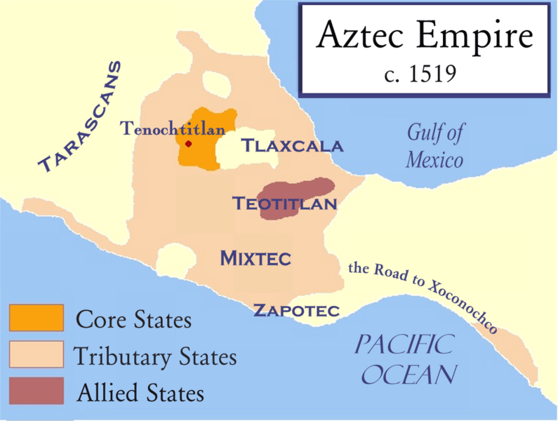
Description: This map represents the core states, the tributary states, and the allies of the Aztec Empire as it stood shortly before the Spanish conquest of Mexico. The borders should be considered very approximate.
Title: Aztec Empire c 1519
Credit: Based on work by historicair which in turn was based on Madman2001's work.
Author: Badseed based on work by historicair which in turn was based on Madman2001's work.
Usage Terms: Creative Commons Attribution-Share Alike 3.0
License: CC-BY-SA-3.0
License Link: http://creativecommons.org/licenses/by-sa/3.0/
Attribution Required?: Yes
Image usage
The following page links to this image:

All content from Kiddle encyclopedia articles (including the article images and facts) can be freely used under Attribution-ShareAlike license, unless stated otherwise.