
Image: Baikal sea
No higher resolution available.
Baikal_sea.png (787 × 583 pixels, file size: 105 KB, MIME type: image/png)
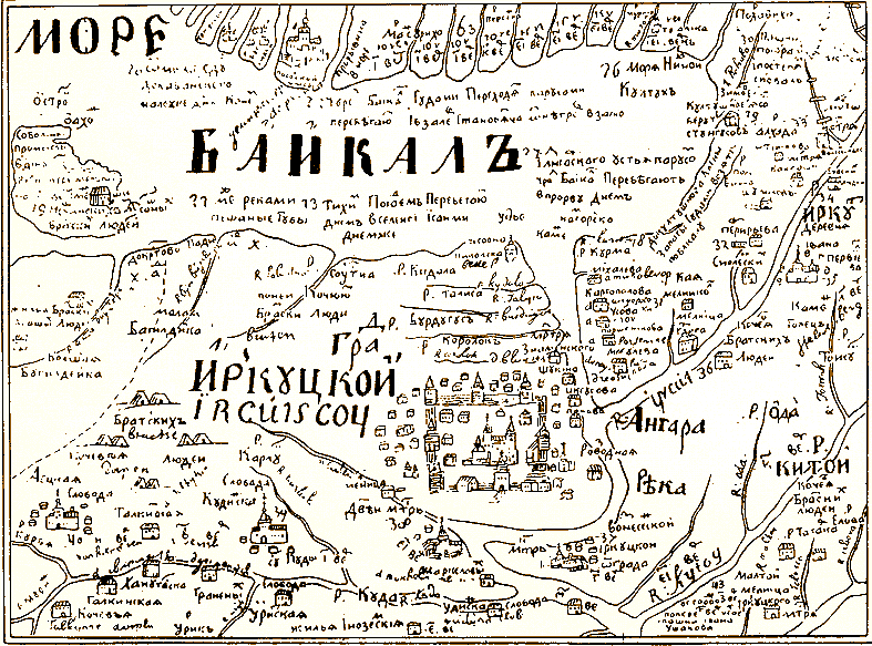
Description: Ancient schematic map by S. U. Remizov dated 1699–1701 of Irkutsk city and the nearby territories (not in scale and distorted: Lake Baikal is drawn much smaller. North is in the bottom of the map. All the signs are in old Russian orthography, but easily recognizable for Russians (the difference: «Байкалъ» – «Байкал», «Градъ Иркуцкой» – «Город Иркутский», «Ангара рѣка» – «Ангара река»). Lake Baikal is called «Baikal Sea» («Море Байкалъ»). Scanned image, sourse
Title: Baikal sea
Credit: www.baikal.ru
Usage Terms: Public domain
License: Public domain
Attribution Required?: No
Image usage
The following image is a duplicate of this image (more details):
The following 2 pages link to this image:

All content from Kiddle encyclopedia articles (including the article images and facts) can be freely used under Attribution-ShareAlike license, unless stated otherwise.